An easy-going to moderate Redmires reservoir walk on the outskirts of Sheffield on mostly easy-to-follow paths with stunning views over Redmires reservoirs and overlooking the Rivelin Valley.
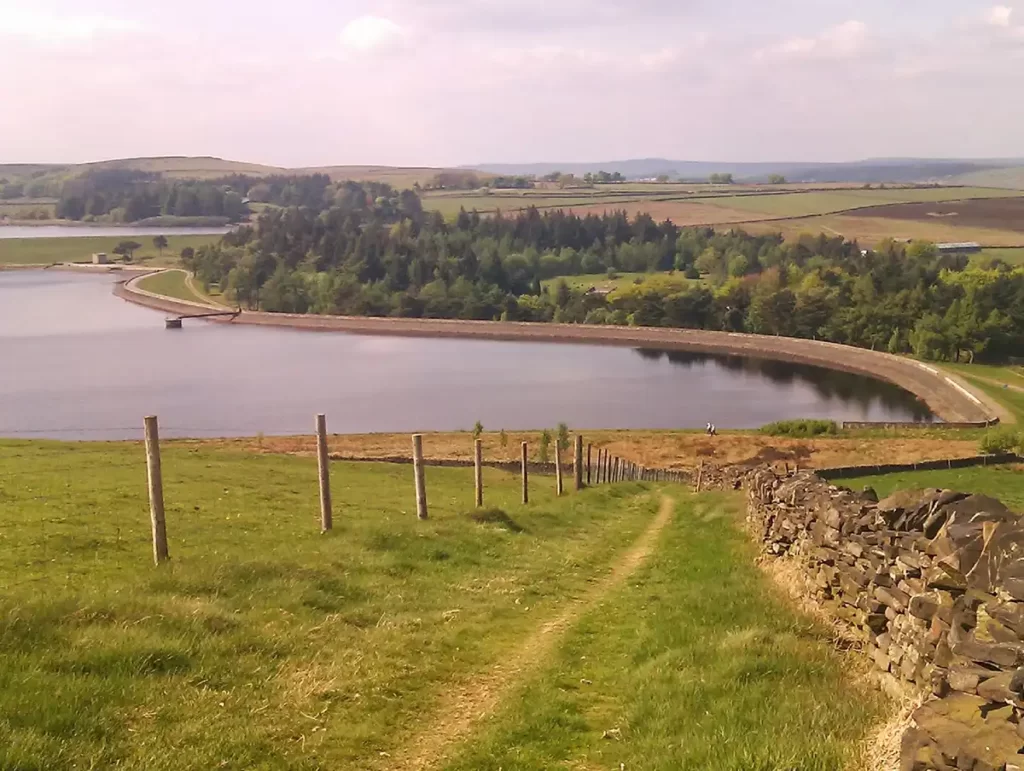
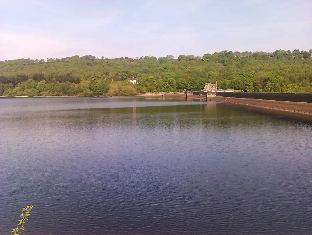
Redmires reservoirs, lying west of Sheffield just outside Lodge Moor, on the edge of the populated areas, are some of Yorkshire’s oldest reservoirs dating from 1836, supplying drinking water down to Barkers Pool in Sheffield’s city centre.
This walk climbs to give clear views over the group of 3 reservoirs, before heading over to the top of Rivelin Valley, dropping down to Rivelin dams and Fox Holes, then heading back uphill through pleasant woodland, visiting the edge of Lodge Moor before following a water course back to the start.
Redmires Reservoir Walk Overview
Distance: 8.15 miles (13.12km)
Total Climb: 161m /528ft
Time: 3.5 hours
The time is loosely based on Naismiths Rule and will vary depending on the walker.
Get this route on the OS maps website & app
Getting There
By Car:
Start from the corner of Soughey Lane and Brown Hills Lane (SK 271 855). Parking is available on the corner at the start or at the roadside nearby, making sure not to block farm entrances and turns for farm vehicles.
By Public Transport:
The walk, being a loop, can be joined at the Lodge Moor section if travelling by bus from Sheffield City Centre. Catch Service 51 (Travel South Yorkshire Website) alighting at the Shiny Sheff pub on the corner of Crimicar Lane and pick the walk between Lodge Lane and Soughey Lane near to the end of the walk description, then continuing from the start.
Soughey Lane to Redmires Reservoirs
From the start, head east along Brown Hills Lane and continue along the road past the first Public Footpath sign on your right. Follow the next Public Footpath sign to your right, just before the road junction over a stile, climbing up through two fields to meet the road at a sharp corner.

Turn right and head west along the track (Public Footpath), keeping straight ahead through 2 gates and following the track as it eventually bears right and heads downhill towards Redmires Reservoir.
Cross a stile then, ignoring the first “circular walk” sign pointing to your left, and remain straight ahead to join the waymarked circular walk heading anticlockwise around the reservoir.
Walk Around Redmires Reservoirs

As you emerge at the road, turn left, following the road as it runs to the right of the reservoir. Ignoring the first footpath on your right (marked “Easy Going Trail”), follow the road as it turns slightly left, and continue along the road towards the left-hand bend and a car park.
Around Redmires Reservoir Walk to Head Stone Bank
Take the next footpath on the right before the Car Park, passing through a gate and heading uphill then through another hand-gate. Continue straight ahead (north) with a wall to your right. Soon the path dips down to a wooden footbridge over marshy ground, then over a stile.
Continuing straight ahead on a clear path until you reach a bridge and a path junction, with a path coming in from the right and a gate and stile straight ahead. Keep straight ahead over the stile and continue along this path until it crosses a stream (which may be dry). After a further 75 metres or so, reach a path marker post and turn right, along the top of Head Stone Bank.
Head Stone Bank to Wyming Brook Reserve
Head east along Head Stone Bank, eventually reaching a wooden hand-gate. Keep to the path by young trees, then enter a wooded area at the edge of the Wyming Brook Nature Reserve. Keep to the path as it generally winds its way through the trees. The path becomes indistinct here and it is easy to lose. If the path becomes difficult to follow, keep east-southeast to find a very steep but becoming clear path, heading downhill to the lane. At the bottom of the slope, turn right along the lane. Follow the lane as it turns right then bears left over a bridge.
Wyming Brook to Rivelin Dams & Fox Holes Lodge
At a junction on the lane, with an 8′ high stone wall to your right, bear left downhill and continue down to Rivelin Dams; staying on the lane until you pass through a road gate and join a single-track road. Stay on this quiet road until you reach the corner of Rivelin Dams and Fox Holes Lodge.
Climb Fox Holes Plantation
Pass Fox Holes lodge on your right then immediately head half-right on the wide Public Footpath leading behind the car park (ignoring the other Footpath on the right heading uphill). Follow this clear path as it gently climbs, with one short moderate ascent, through the trees then easing off. After a second brief ascent up a short rockier section of path, at the brow, a path joins from the right. At this point keep going straight ahead with a steep drop to your left.

At a Public Bridleway sign, go half-right then keep straight ahead on the Public Footpath. Descend stone steps and over a stream. Immediately head up the stone path and follow this uphill to eventually emerge from the woods at a bridleway junction. Here, turn left (east) and pass behind the houses, with a clear view over the Rivelin Valley and over to Stannington. Keep straight ahead ignoring the gravel path which heads downhill to your left.
Lodge Lane Back to Soughey Lane
Cross Lodge Lane (a minor road descending very steeply to left) and continue straight ahead (east) along the Public Footpath. Pass a viewpoint with two benches and continue with a stone wall to your right, through woods, As the wall ends to your right, head right down a steep descent to cross Black Brook. Note: An easier descent can be had if preferred by carrying straight ahead after the wall ends then keep right at path junctions to double back and descend to the brook.
Cross the brook and climb uphill keeping left. Continue east along the path, a metal fence comes in from your right which then becomes a stone wall. Keep a careful eye out to your right just after the metal fence becomes a wall. Just after the wall begins, head right through a gap in the wall, and keep to the footpath as you cross the golf course with care.
(* Start here if using public transport to reach this walk)
Exit the golf course with the Shiny Sheff pub directly in front of you, cross the road and continue straight ahead up Crimicar Lane. After the second road on your right, follow the Public Footpath sign on your right beside a sports field and past a playground. Cross the road then continue straight ahead (west). After you pass the houses, the path is bordered on each side by a stone wall and a water channel just to the left of the path (Redmires Conduit). Cross the next road (Lodge Moor Rd) after a double stile and continue along the footpath (ignoring the bridleway). The path continues, past a track on the right which leads to the pub, then past woods on your right; and eventually emerges back on Soughey Lane. Turn left and head up the road to return to the start (or if using public transport, continue the walk from point 1).