An easy Ladybower walk with a moderate climb out from the Upper Derwent Valley. An ideal starter walk which is not too strenuous and very easy to follow.
With a moderate climb, steep enough to catch the breath of a non-seasoned or out-of-fettle walker and instil an air of real achievement at the top, the route offers beautiful views over the Upper Derwent Valley, Ladybower reservoir and the Ashopton Viaduct – passing over the now extinct village of Ashopton that was flooded to make way for the reservoir in the early 1940s.
Ladybower Walk Overview
Distance: 6.5 Miles (10.5km)
Total Ascent: 333m /1094ft
Time: 3 hr 15m
Map: Ordnance Survey OL1 (The Peak District – Dark Peak Area)
Get this route on the OS maps website & app
The time is loosely based on Naismith’s Rule and will vary depending on the walker.
Getting There
By Car:
Parking on a weekend or a bank holiday is at a premium in this particularly popular area. This Ladybower walk text starts from the roadside (free) car parking on the A57 beside the Ladybower reservoir on the left-hand side of the road heading west out of Sheffield, just past the Ladybower inn, after the traffic light junction which branches off to Bamford. If as often happens, the parking is full, take a right into the Upper Derwent Valley and park in the nearest available car park, easily picking up the route from your parking spot. Parking remains free until you reach the Fairholmes car park which is a pay and display but does have the advantage of a small cafe, shop and toilet facilities.
Public Transport:
Bus Services 256/7/8 between Sheffield and Bakewell serve the Heatherdene car park a short walk from Ashopton viaduct hourly on weekdays during the daytime but more infrequently at the weekend, it is worth checking timetables and planning carefully as you may be in for a long wait if you miss a return bus. Trains between Sheffield and Manchester stop at Bamford railway station, as does Bus Service 272 but the connection to Ashopton is via the same 256-8 services. Walking from Bamford railway station to Ashopton viaduct is an option but adds an additional 3 miles each way so doubling the length of the walk to a 12+ mile day out
Ashopton Viaduct to Fairholmes alongside Ladybower Reservoir
From the start at Ashopton Viaduct head West beside the road towards the Upper Derwent Valley. Just before the viaduct, cross the road carefully and continue alongside the A57 over the bridge, turning right at the Upper Derwent Valley road, through a hand gate and following the easy-going trail which drops down towards the banks of the Ladybower reservoir then follows a clear wooded path just above the banks of the water.
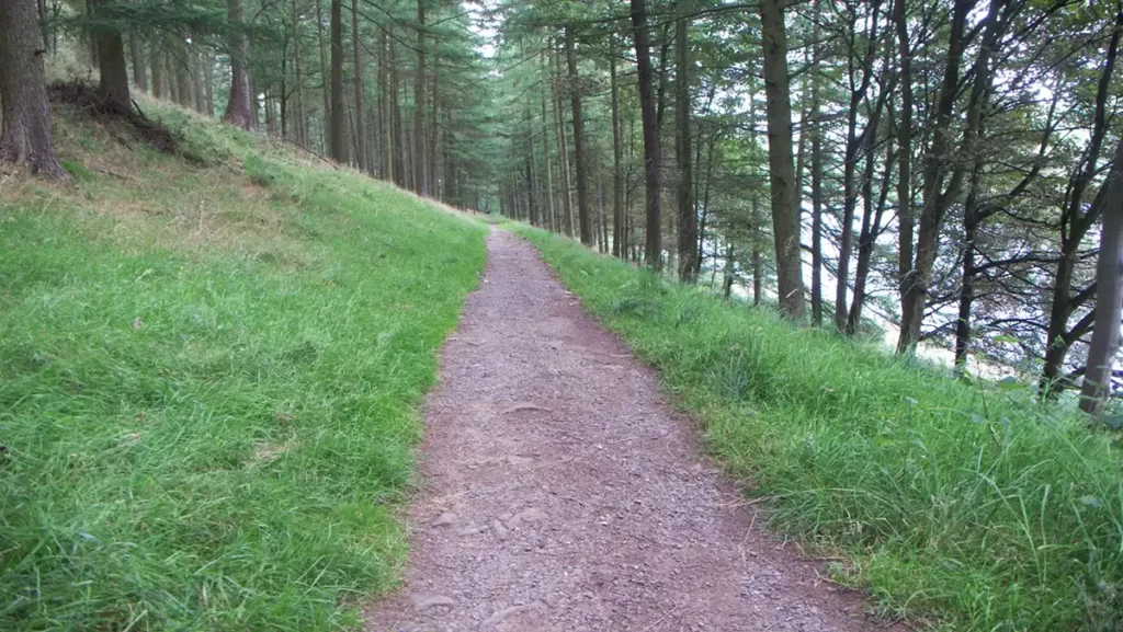
Keep following this trail which is clearly signposted, until you reach the exit road of the Fairholmes picnic area and car park.
Alternatively, if parking was not possible at the viaduct, join the walk at any point along this section of the route where parking is available – follow the road north from your parking spot until you reach either Fairholmes or an access point to the trail beside Ladybower.
Fairholmes to Lockerbrook
A few metres before you reach the car park exit road, turn left and pass through a gate and a sign pointing to Lockerbrook. You will note a green arrow alongside red and black arrows indicating a waymarked route. For the first half of the walk, you will be following the green arrows.
Follow this path as it ascends through a wood and emerges at a forest track. Keep following the green waymark arrows going left along the track then, after a right-hand bend in the track, turning to the left back into trees

Stay on this route, still following the green waymarks, and finally emerge at a track near Lockerbrook farm.
Lockerbrook Farm to Crook Hill
Turn left and walk down past the old farm / outdoor centre.

After the old farm, the track bears left then right. Follow the track to the ridge and a path junction with a clear path heading right, a wider track heading downhill, and a narrower footpath bearing left along the top of the Hagg Side woods
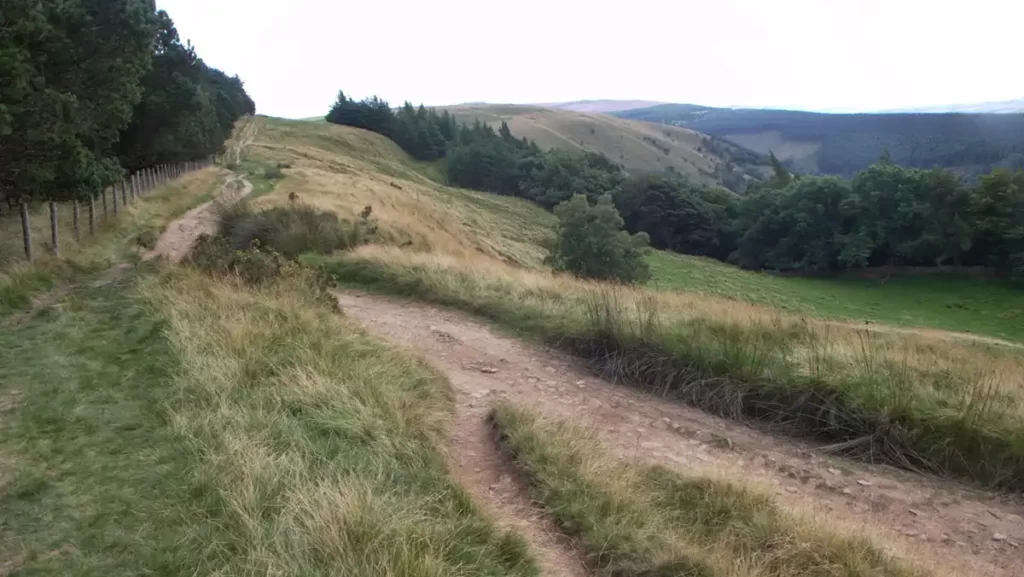
Take the left path which once again is marked with a green waymark arrow. Continue along this bridleway which becomes multiple narrow tracks until you reach a stile to your left and a gate heading straight on/slightly right.
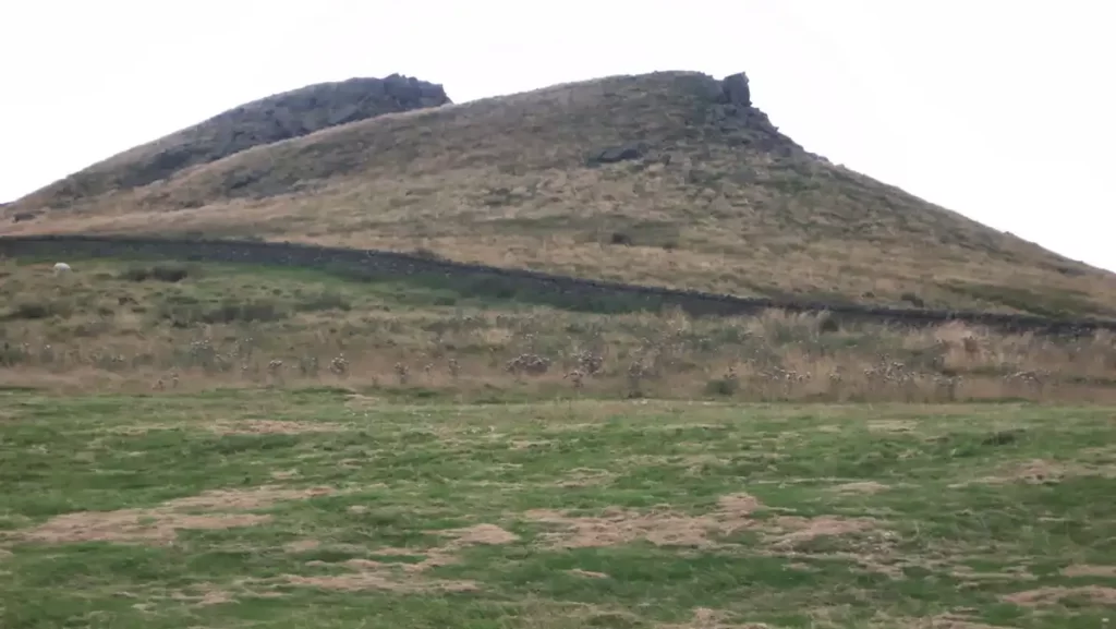
This is where you leave the green waymarked route which heads back down to the reservoir. Instead continue along the top bridleway, following the top of the woods. Eventually, the woods drop away to your left. Continue along towards the twin tors of Crook Hill. (You may choose to explore as they are on access land and provide a stunning view on a clear day)
Crook Hill to Crook Hill Farm
To continue the walk, keep following the bridleway which is mostly clear. Although it gets briefly faint in places it is easy to follow and eventually comes to a gate and a farm track. Shortly after the beginning of the track, just before you reach the working Crook Hill Farm you will come to a gate to your left and a signpost giving directions to avoid passing through the farm.
Although there is a right of way through the farm there is no benefit to be gained from following it. Instead, follow the instructions given on a signpost.

Crook Hill Farm to Ashopton Viaduct
Pass through the gate on your left and head diagonally right across the field to the gate that is visible in the far corner. This emerges on a lane with another gate immediately opposite. Go through this gate, around the side of the barn and look for the gate in the wall slightly to the right.
The clear footpath continues to drop diagonally through fields heading directly to the main A57 and the Ashopton Viaduct.
Near the bottom of the hill, the path turns slightly left to head steeply downhill by the side of hedgerows to a gate near the end of the Upper Derwent Valley road.

Your path to the end of this Upper Derwent Valley Ladybower walk now depends on your parking location
If you parked on the A57 before the viaduct: Turn right and follow the path along the main road over the viaduct back to your car.
If you parked along the Upper Derwent Valley road or Fairholmes Visitor Centre: Turn right and walk a few yards along the road towards the A57, until you reach a cattle grid and a hand gate on your left. Go left through the gate and follow the clear path running alongside the reservoir.
NOTE: If parking down the Upper Derwent Valley road, it is a good idea to look out for the war memorial about halfway down the road to Fairholmes, as this memorial is also visible from the path, which will give an indication of how far you need to follow the path, and save you from overshooting your car parking space and walking too far towards the Visitor Centre