Monyash Loop via Lathkill Dale Walk Overview
A pleasant Lathkill Dale walk beginning from the village of Monyash heading over classic white peak farmland (with plenty of stone walls and stone stiles) joining the Limestone Way to reach Lathkill Dale via One Ash Grange Farm. At Lathkill Dale the route heads gently up the stony path, back to Monyash.
Distance: 4.12 Miles (6.6km)
Total Ascent: 495ft / 151m
Time: 1hr 55mins
The time is loosely based on Naismith’s Rule and will vary depending on the walker.
Directions
Monyash Car Park to the Limestone Way
From the Monyash Car Park and Toilets, cross the road and head through the handgate into Bagshaw Dale. Follow the clear footpath over fields and stiles northwest, gently curving around to the left until you reach a road by a junction. Turn left to the junction, then left again, to head south into the centre of Monyash.
Turn left in the centre of the village, passing the Bulls Head pub. (If you parked in the village itself you will start your walk roughly here). Walk along the road until you reach St. Leonard’s Church on your right.
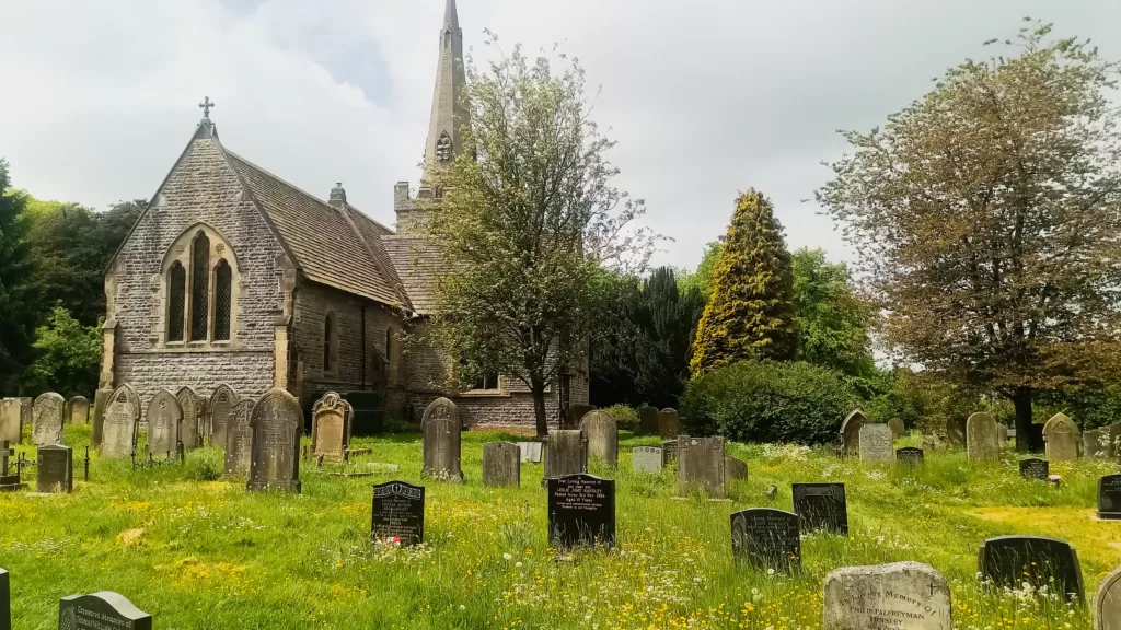
Turn right at the public footpath sign, into the churchyard, and walk through the graveyard to a stile at the far end. Cross the stile into a small field, and continue to a hand gate. Pass through the gate and follow the footpath, with a stone wall to your left and a fence to your right. After the next stone stile, keep straight ahead, roughly along the right of the field, then bearing towards a finger post and stile ahead-right. Cross this stile and turn left, heading uphill on the Limestone Way track.

Limestone Way to One Ash Grange Farm
Stay on the clear track with walls on each side and follow this until the track ends at a hand gate/stile. Go through the hand gate and continue with a wall on your right, until you reach a finger post and hand gate on your right. Pass through the gate, signposted “Limestone Way”

Head diagonally across the field, towards a gate and marker post. Climb over a stile then continue, keeping left alongside the wall, climbing through two fields. Towards the far side of the second field, take the stone stile on the left, then continue along with the stone wall now to your right.
At the end of the next, large, field take the gate onto the clear track which leads down to One Ash Grange Farm.

One Ash Grange Farm to Lathkill Dale
Follow the marked path through One Ash Grange Farm, keeping roughly straight ahead between the buildings. Pass beside some old stone barns beside a newer metal barn then descend some steep steps before walking down the lower part of the field.
Pass through a hand gate then descend the rocky steps carefully which drop down into the northernmost end of Cales Dale. This short section of path is rough and steep as it descends down to the bottom of the dale.
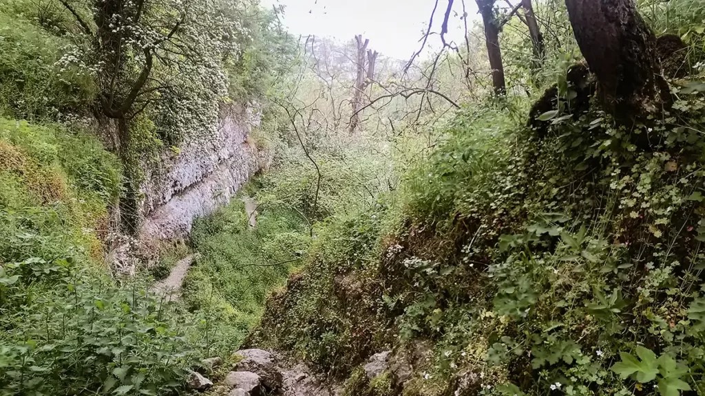
At the bottom, turn left, ignoring the steep steps ahead-right, and follow the path to the end of Cale Dale, to join Lathkill Dale at a footbridge.
From Lathkill Dale Walk Back to Monyash
Lathkill Dale is a nature reserve with some of the clearest water in the shallow river – for this reason walkers with dogs are asked to keep dogs out of the water, so that delicate plant life on the river bed is not disturbed. From this footbridge, you have an option to head right alongside the river to explore the riverside path if you desire, however our route heads left here, to return to Monyash.
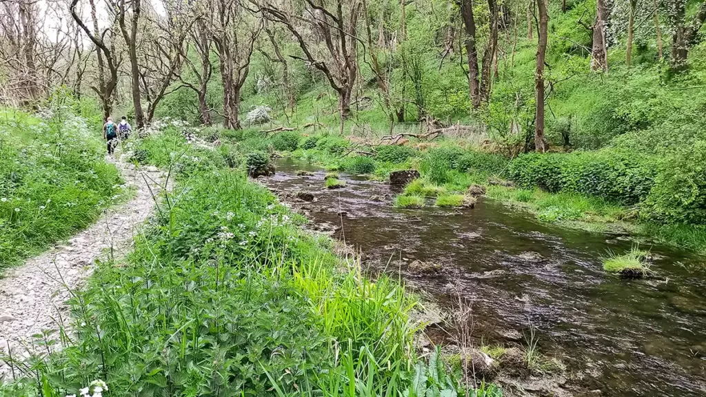
Turn left at the footbridge and walk along the stony path. The path is not difficult although there are uneven sections requiring care, with cobbles to turn the unwary ankle, especially for walkers in approach shoes rather than supportive boots. Dogs and people should stick to the path to avoid any old mine shafts.

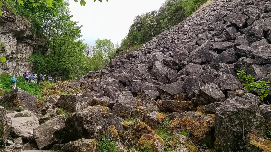
The route is easy to follow as it climbs gently up the dale. Pass by the rocks and boulders of the now disused Ricklow Quarry and continue. At a path junction a little after Ricklow Quarry, keep straight ahead through fields to the dale head and the Monyash Car Park.
If you started your walk from the village centre, or from north of the village, cross the road and continue to your start point by following the first short section of the walk description, through Bagshaw Dale