This North Lees Chapel walk route begins from Hook’s Carr and takes in the popular Stanage Edge before dropping to North Lees passing Dennis Knoll. After visiting the site of the ruined chapel, the route returns to Hook’s Carr via the quieter Carhead Rocks on Cattis-Side moor with panoramic views of the Hope Valley.
Distance: 4.58 Miles (8.2km)
Total Ascent: 799ft / 244m
Time: 2hr 15mins
Hook’s Carr, along Stanage Edge to Dennis Knoll
From the car park head up the path through the stone wall at the top of the car park (close to the road junction) heading towards the rocks of Stanage Edge. Reach a path junction by a wooden barrier and bear right, uphill. Where the path forks again, take either left or right, both lead up to the top of Stanage Edge.
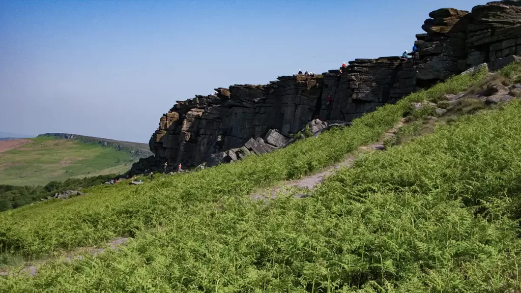
Upon reaching the top of Stanage Edge, turn left. (Trig point baggers may wish to turn right first and walk the short distance to the trig point which lies a short distance to the east, along the path.) There is little in the way of navigation to worry about here, simply follow the path along the top of Stanage Edge. Keep left of a stone wall where it appears, to stay on the stone and rock path rather than eroding the peat moorland.
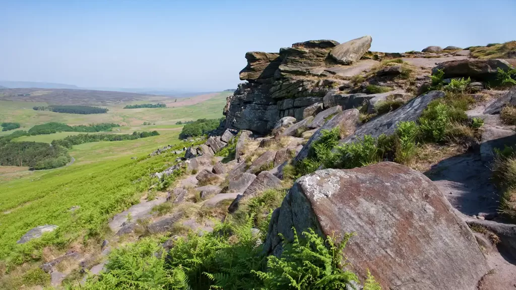
The gritstone escarpment of Stanage Edge is a popular destination for climbers, walkers and families, this section of the walk is not one where you are likely to find solitude (as opposed to the rocks on the return leg which can be deserted on the very busiest days).
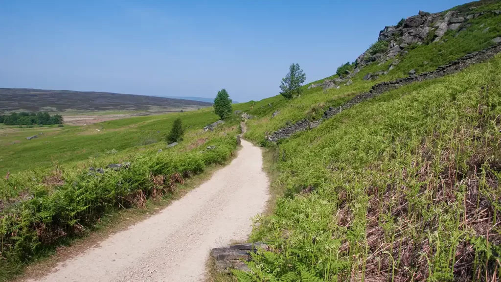
Eventually, the Stanage Edge path reaches a junction at a wide gravel track. Keep left (straight ahead) to follow the track (Long Causeway) as it descends, with High Neb above to the right. Continue on Long Causeway to the very bottom of the track to arrive at the Dennis Knoll car park.
Dennis Knoll to Holy Trinity Chapel at North Lees
At the car park, turn left along the road. Walk down the road with the woods of Dennis Knoll to your right. As the woods on the right come to an end, cross a cattle grid then turn right through a handgate alongside Dennis Knoll.
Walk alongside the woods and stone wall to your right. At the end of the woods, ignore a hand gate to the right and keep straight ahead down the clear path. The path descends alongside the stone wall, then bears right and over a tall 3-step stone stile over a wall.
At a path junction, pass through the gap in the stone wall on your right and continue in the same direction, heading downhill. Bear left past an old gate post and down through a handgate towards Green’s House. Descend through another gate then head left, briefly along the track before crossing a stile beside a gate. After the stile, keep straight ahead, signed “Stanage via North Lees”

Walk along the track between stone-walled fields, then bear half-right where the walls end, heading diagonally down the field to a gate and stone stile. Cross this, then shortly after another stile, then the path descends into a shaded area. Ford a small stream and keep right as you pass remains of some ruined buildings, with a spring in the high wall on the left.
Keep right, over stepping stones and climb through a gate. Ascend the path with the chapel ruins coming into view ahead-right. Stay on the path until you reach a sign “Holy Trinity Chapel” on your right. Turn right to walk down the field to the remains of the building.
Holy Trinity Chapel, North Lees
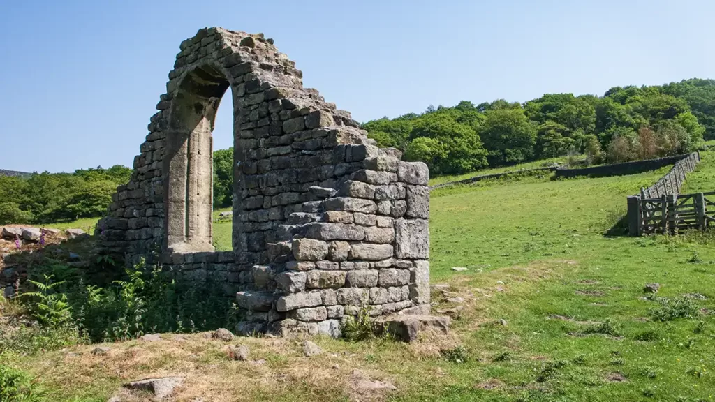
Holy Trinity Chapel is a small, ruined Roman Catholic chapel. It is thought to have been built in the 16th century, and last used by Richard Fenton, the last Catholic owner of the estate in around 1590. The chapel was then abandoned and fell into disrepair.
In 1685, during the reign of James II, the chapel was repaired and reopened for Catholic worship. However, it was destroyed during the “Glorious Revolution” of 1688, when James II was overthrown by William of Orange. The chapel has remained in ruins ever since.
The chapel was a single-cell building measuring approximately 13 metres by 6.7 metres, made from rubble stone, located on a small hill, close to a pre-Christian well now known as Trinity Well.
The ruined chapel is a Grade II listed building.
Holy Trinity Chapel to Cattis-Side Moor
After visiting the chapel, return to the path and continue uphill, climbing up through two gates. The gritstone face of Stanage Edge is now clearly in view ahead-left.
The path now descends slightly and it contours left and into woods via a gate. Climbing up through the woods, follow the path as it heads uphill, staying straight-ahead as you pass steps heading up to the left*. Towards the top of the climb, the path swings right and up to a gate and onto the road. Turn right along the road and around the right-hand bend to reach a road T-junction.
*If you wish to avail yourself of the toilet facilities, head left up the steps and then, after the WC, head right, down the narrow lane until you reach the T-junction.
Turn right at the junction, over a cattle grid and then turn immediately left up the dirt path onto Cattis-side moor.
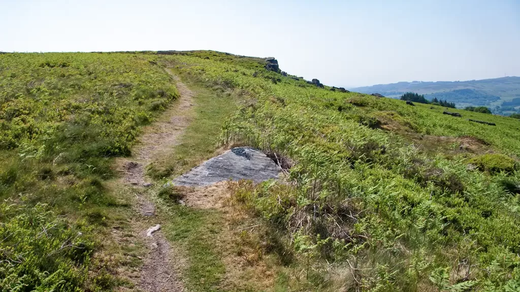
Cattis-Side Moor & Carhead Rocks Back to the Start
Climb up the path which ascends onto Cattis-Side moor, heading towards the stones of Carhead Rocks which come into view as you climb gently onto the moor.
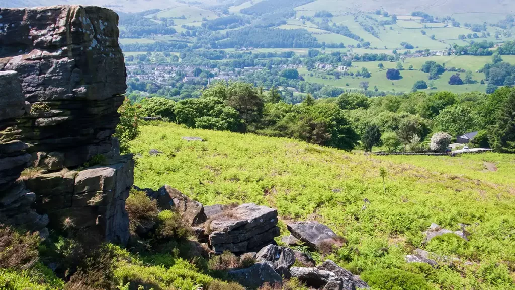
As you climb you gain incredible views all around the eastern end of the Hope Valley. Ahead of you, you can see the hilltop of Sir William Hill (with the radio mast atop, just beside the peak of the hill) above Grindleford. Looking left you can take in much of the Hope Valley and the hills that surround it, whilst behind you stands Stanage Edge.
As you continue along the moor, you reach the small escarpment at Carhead Rocks, from where you can see the town of Hathersage ahead and below. Despite this impressive vista, next to the more imposing edges, Carhead rocks as a walking destination is overlooked by many. The bonus of this is that even on busy summer days, you can have much of this moorland to yourself!
Walk along the top of Carhead rocks until you reach the far end, at a stout, square wooden post. Turn left at the post, following the path and passing a second similar post. You can see the Hook’s Carr car park ahead, and the path that was ascended at the start of this walk. Follow the path down to join The Dale road through a handgate. Turn left along the road, over a cattle grid to the junction and back to the car park.