About This Walk
This walk along Gardoms Edge visits the lesser traveled gritstone edge with wide views over Baslow and the Chatsworth Estate, Curbar, and more. Gardom’s Edge is often missed by peak district visitors as being tree-lined it is hidden from view from below.
Beginning from the Clodhall Lane crossroads on the A621 between Owler Bar and Baslow, this route is mostly easy-going with one short section of steep descent through bracken. The beginning section can be muddy in winter or heavy rain so waterproof footwear is recommended.
Distance & Elevation
Distance: 2.25 Miles (3.6km)
Total Ascent: 291ft / 89m
Time: 1hr 5mins
Traveling by Car:
Roadside Parking on Clodhall Lane, near the crossroads with the A621 Sheffield to Baslow road. Turn left at the crossroads if traveling south from Sheffield. Close to Bar Brook Bridge (DE45 1PQ)
Traveling by Public Transport:
Bus Service 218 Sheffield – Chatsworth – Bakewell stops at the Bar Brook Bridge bus stop next to the crossroads at the beginning of the walk
Ordnance Survey Map & App
Map: Ordnance Survey OL24 (White Peak)
Get this route on the OS maps website & app
Komoot
The time is loosely based on Naismith’s Rule and will vary depending on the walker.
Sheffield Road to Birchen Edge
Walk down Clodhall Lane to the crossroads with the A61. From the side OPPOSITE Bar Brook Bridge, head through the hand gate heading south, first on stone paving slabs, then on grass. Soon, the path forks. Bear left onto a narrow but clear path.
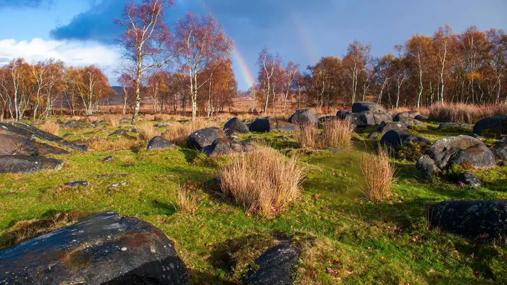
Follow this path which may be wet and muddy in winter or after a period of rain as it winds its way through reedy grass. Upon reaching a group of trees, the path begins to climb up between heather and bracken. At a fork in the path bear right, still climbing steadily.
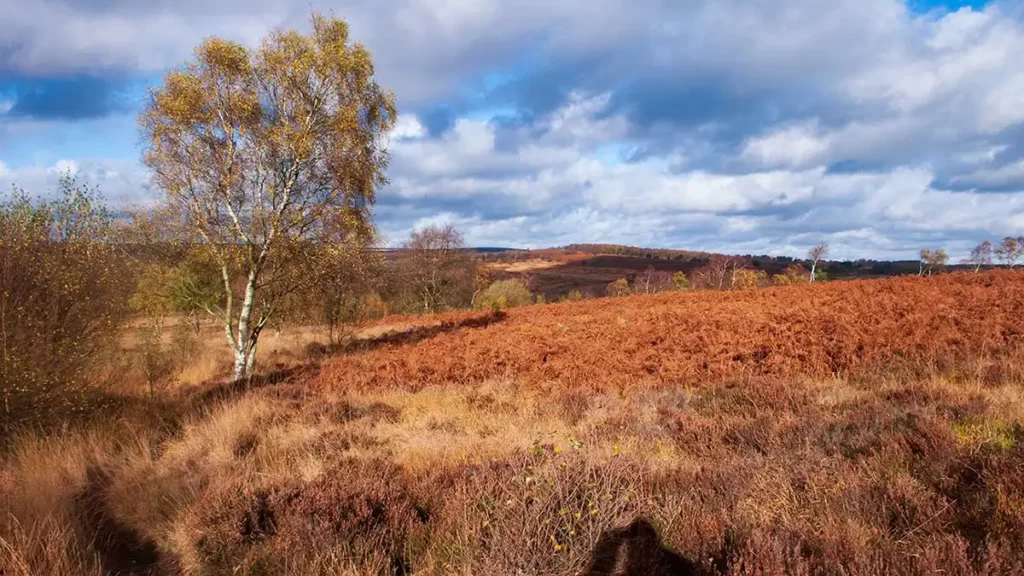
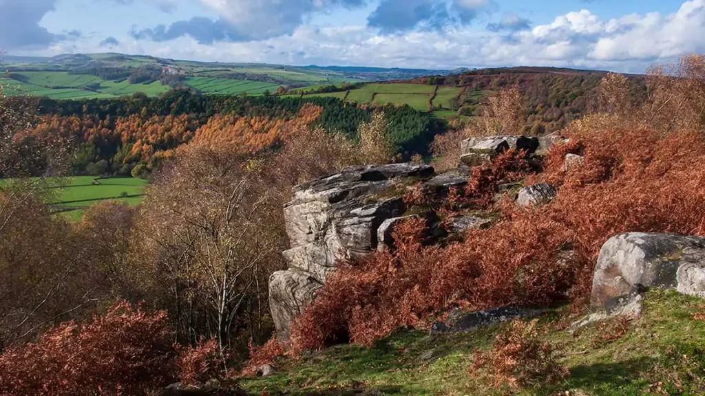
After a short ascent, the path levels out a little as it heads along the moor. Soon, views across Chatwoprth, Curbar, Froggat, and, in the distance Sir William Hill above Grindleford, come into view on your right.
Continue along this path until it dips slightly and reaches a path T-junction just before a rock outcrop at the start of Birchen Edge. At some times of the year, the path to the right may be partially obscured by bracken growth. (If you reach the trig point you have gone too far – retrace your steps to the junction.)
Birchen Edge to Gardoms Edge
Just before the rock outcrop, turn right onto a path that descends very steeply through the bracken. Take care descending as the surface is steep and uneven and may be masked by bracken in the summer.
After the short, steep descent, the path levels out and then reaches a clear path crossing left to right, alongside 3 silver birch trees. Turn left along the path, ascending slightly.
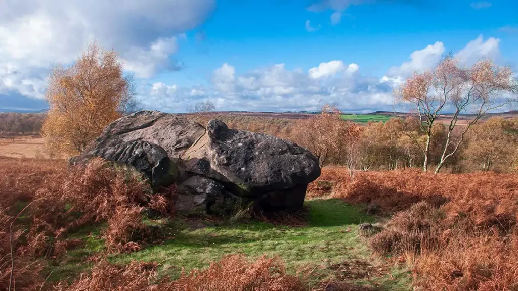
As you draw level with a large rock on your right, turn right. Walk up to and immediately right of the rock. After passing the rock, head slightly downhill along the path through bracken, heading towards the right-hand corner of a stone-walled enclosure.
As you pass the corner of the enclosure wall, the path bears slightly right and then forks. Take the left fork, walking parallel to the enclosure wall. The path follows the line of the wall, passing by a gate on your left, after which the path runs immediately adjacent to the wall.
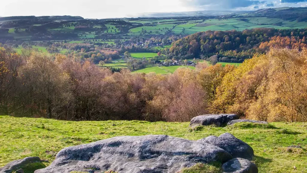
Continue alongside the wall as another path joins from the right, to reach a stile over a stone wall. Climb the stile to reach Gardoms Edge. Ahead you can see views of Baslow and Chatsworth below.
Walk Along Gardoms Edge
After climbing over the stile turn right along Gardom’s Edge As the edge is tree-lined it does not initially offer the same wide views along a precipice as some of the more popular dark peak edges do. It is well worth spending some time exploring the edge between the trees, instead of briskly marching along the route. The main path is easy to relocate along this section as it runs alongside the dry stone wall.
Work your way along the edge following the line of the wall. until you reach a wall corner. Continue straight ahead, stepping over the broken wall to the left. You will notice a hand gate on your right on the other side of the wall. Ignore this and continue along Gardom’s Edge.
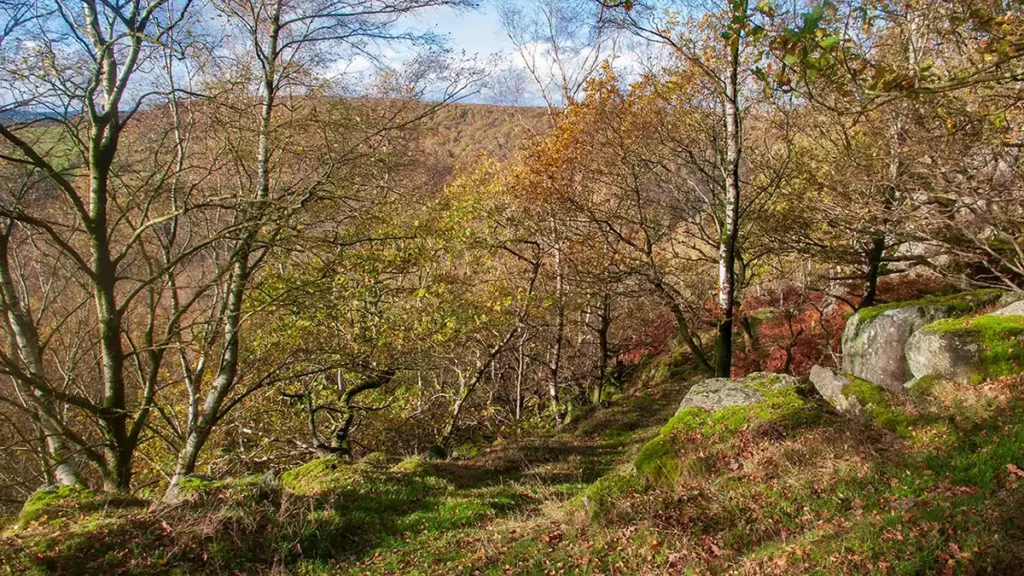
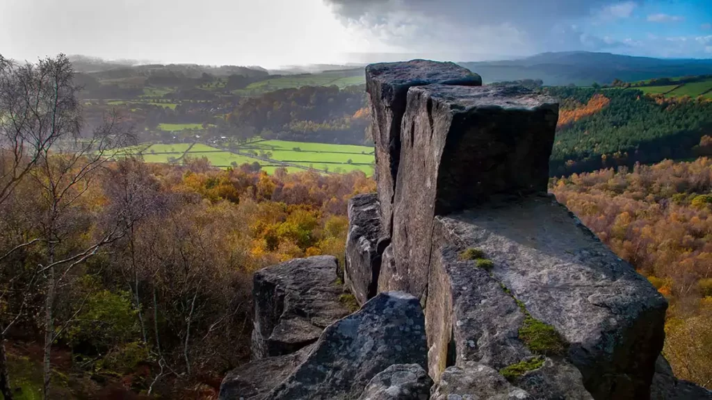
After crossing the broken wall, the edge takes on more of the classic characteristics of a peak district gritstone escarpment. The path runs closer to the edge with its promontories and outcrops, allowing for tremendous views.
Continue along the path beside the edge, eventually passing a group of rocks that almost look like a giant stile on your left. As you reach the end of Gardom’s Edge, the path bears to the right between birch trees and then through bracken to reach a hand gate.
From Gardoms Edge Walk Back to the Start
Head through the gate, then walk straight ahead on the path, ignoring a stile to the left. Pass a second stile, again, keeping straight ahead on the path. The main Baslow-Sheffield road is now clearly seen to your left. Birchen Edge can be seen rising to your right.
Follow this path, watching your footing as you pass a few wet sections with deep puddles. The path runs more or less parallel to the road as it heads back to the gate at the Sheffield Road/Clodhall Road junction and the start.
Gardoms Edge
Gardom’s Edge is a gritstone escarpment that rises above Baslow in the Dark Peak area of the Peak District. Despite offering fantastic views across the Derwent valley, Baslow, and the Chatsworth Estate, and of the hills rising opposite, it is much ignored by walkers and climbers alike. Perhaps this is due to much of the edge being masked by trees. Although it runs close by the busy A621 Sheffield to Baslow Road, many who are familiar with many of the other similar rock formations in the region, seem blissfully unaware of this hidden gem.
It may be because the edge is so well camouflaged from below, and many possible climbing routes obstructed by the woods, that the edge has not gained popularity amongst climbers and walkers. Whilst Gardom’s Edge isn’t the tallest of its kind in the area, as it begins reasonably high above sea level it does offer fantastic views on a clear day for miles around.
