About This Walk
Starting from the Aysgarth Falls visitor centre this walk visits the Middle and Lower Force waterfalls before heading up the River Ure to Redmire Force. The route then heads up through the village of Redmire to Castle Bolton before dropping down through countryside to Carperby and through Bear Park to visit Upper Force on the way back to the visitor centre and the start.
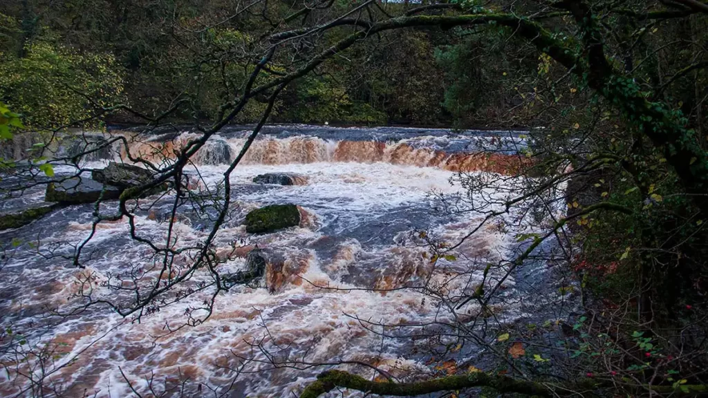
This walk was mapped as an alternative to another Aysgarth Falls walking route that crosses the stepping stones over the River Ure, on a day when the river was high and the stones impassable
Distance & Elevation
Distance: 9.59 Miles (15.4km)
Total Ascent: 993ft / 303m
Time: 4hr 21mins
The time is loosely based on Naismith’s Rule and will vary depending on the walker.
Traveling by Car:
Pay & Display parking in the Aysgarth Falls National Trust Visitor Centre, Church Bank, Aysgarth, Leyburn DL8 3TH
Traveling by Public Transport:
Traveling to Aysgarth by public transport is not straightforward. The most straightforward means is a train to Darlington followed by Arriva X27 to Richmond. From Richmond, Aysgarth village is served by local minibus – Little White Bus Wensleydale Voyager service 156. From the village war memorial walk east along the main road until the Aysgarth Falls Hotel. Turn left after the hotel, and walk down the roads past the church on your right. Cross Yore Bridge then join the footpath which heads up alongside the road, to reach the Visitor centre car park
Ordnance Survey Map & App
Map: Ordnance Survey OL30 (Wensleydale & Swaledale)
Get this route on the OS maps website & app
Komoot
Aysgarth Falls Walk (Middle & Lower Force)
Leave the Aysgarth Falls visitor centre car park by the path beside the vehicle entrance. Walk down the path as it swings to the right, down to the road. Cross the road and pass through the double hand-gate and take the right fork on the path.
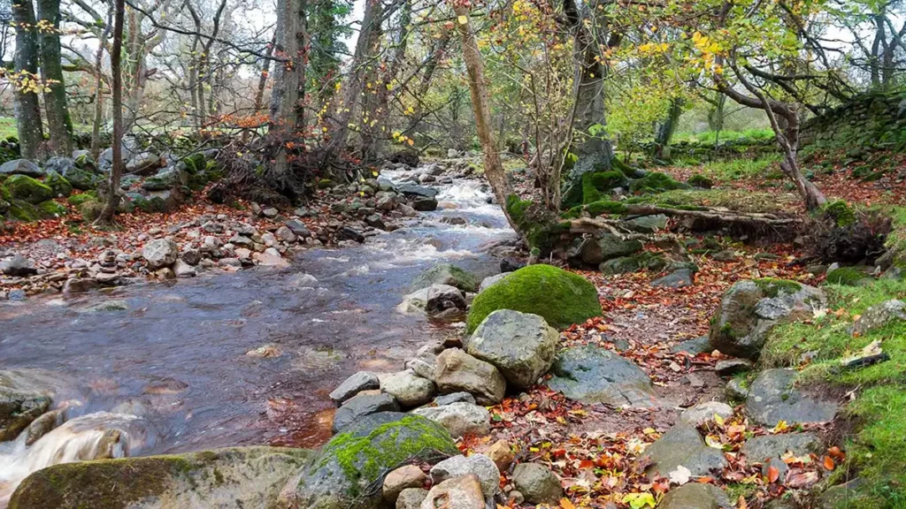
You will soon arrive at steps on your right to the Middle Force viewing platform. Descend the steps for views over the waterfall.
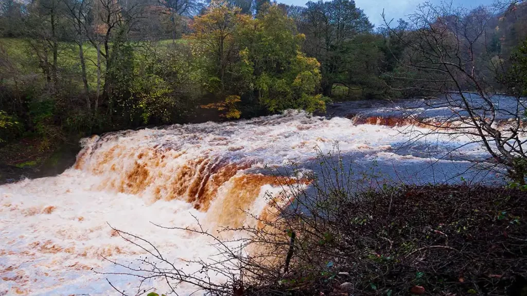
Head back up to and along the path. Pass through another double gate and pass a carved totem bench on your right. There is a one-way path system to the lower falls – walk past the first set of steps on your right signed “Return Path From Riverside”. Follow the main path ahead which curves right then drops down steps and through a gate.
To explore lower force fully, after the first flight of steps, turn left down a sloping path which leads to a scramble down rocks to the riverside. This can be a slippery climb down so proceed with care. You can skip this step if you wish as it is not necessary for the route. After exploring the river bank at the bottom of the falls, climb back up and return to the path junction and steps. Turn left and follow the path along to the top of lower falls.
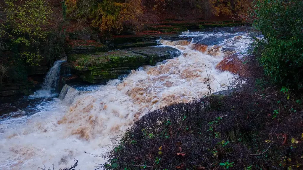
Walk along the rocky riverbank with care, to reach the return path from the falls up the steps ahead to your right.
From Aysgarth Falls, Walk to Redmire
Head back up to the main path through a hand gate. Turn right briefly, then at a path fork before the steps, bear left, signposted “Castle Bolton 2 Miles”. Walk along the footpath between 2 fences and through a gate. The path then bears slightly left, over a hump, to another gate. Continue through the gate and straight ahead across the field to a gate. Walk through an enclosure then a small rough field, climbing to a drive.
Turn right along the drive, passing houses and through a hand gate beside a full gate. Walk along the drive for approximately 30 metres then bear right through a gate into the field on the public footpath. Head along the right of the field to a gate beside a signpost. Go straight ahead through the gate, signposted “Castle Bolton”.
Walking through the field you can see Bolton Castle ahead-left. At the opposite side of the field, reach a gate in a stone wall beside a signpost. Do not head through the gate, instead, turn right and walk with the wall to your left, signposted “Castle Bolton Avoiding Main Road”.
At the corner of the field pass through a squeeze stile and head along the track with a stone wall to your right. The track meets up with another track at a junction – bear right, signed “Castle Bolton” then, almost immediately, turn left onto a grassy track.
The grass track reaches a gate ahead. Go through the gate, after which, the track narrows to a path, passing between hedgerows. Follow this path for about half a mile. As the path reaches Low Thoresby, the path joins a lane. Head straight ahead past the farm and stay on the lane to reach the edge of the village of Redmire.
Redmire Force Waterfall
At the end of the lane, turn right and walk along the lane into Redmire. As you reach the junction at a left-hand bend, where a bench sits beneath a tree, turn right down the lane, keeping right. Follow the lane to the very end and keep straight ahead past Mill Farm, passing through a gate to a path T-junction at a stone wall and signpost ahead. Turn right, signposted “River Ure” and pass through the gate.
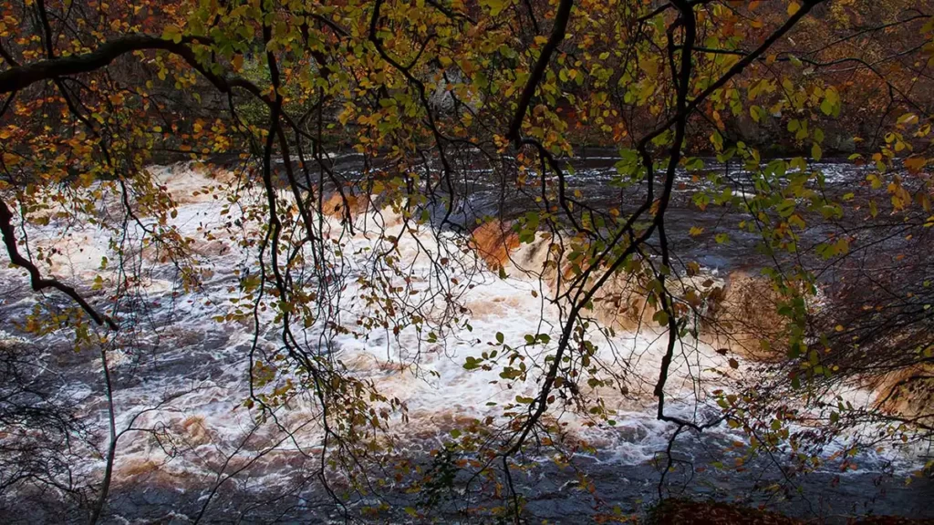
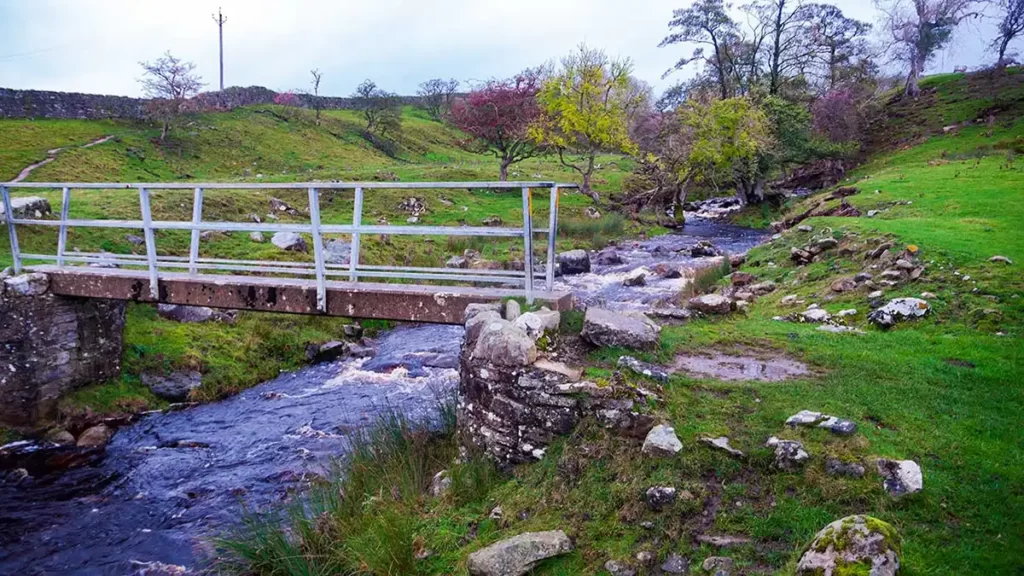
Follow the path beside the river, then cross a bridge fashioned from a wide steel girder into scrubland towards the waterfall of Redmire Force. As you get close to the waterfall, to view it from above, scramble up some naturally formed stone steps to your right (you may need to squeeze along the side of the river to reach them if the Ure is in full spate)
After viewing the falls, turn back and return over the girder bridge and up through the gate, back to the path T-junction near Mill Farm.
At the path junction, keep straight ahead over a stile in the stone wall and over a footbridge. Walk along the path with the River Ure below to your right. Pass through a gate and follow with care, the narrow path which runs along the steep hillside beside the river.

As the path enters a field, turn 90 degrees left, through a gate, and along a path between fields with a fence to your left and a stone wall to your right. The path turns left and then reaches a farm track. Turn right up the track, following it to the end.
Redmire to Bolton Castle
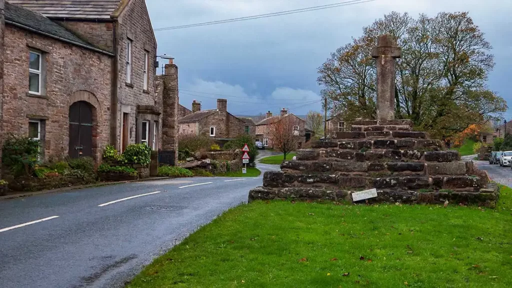
At the end of the track turn left along a lane to the junction. Turn right, into the village, passing the tree and bench on your left. Walk up the main road, passing bus stops first on your right then on your left. Continue up to a T-junction then turn left.
Keep straight ahead past a tree and well on your right, then pass the Bolton Arms pub on your left. Walk up to Hargill Drive on the left, then head up the paved footpath along the green. At the end of the path, at a wall, turn left along a path between houses.
Pass through a gate then bear diagonally left to a squeeze stile. Cross the field straight ahead and through another squeeze stile. Cross over a footbridge just to your right over Apedale Beck and through a stile into a field. Keep straight ahead through the field just beside the stone wall to your left.
At the far end of the field, keep straight ahead through a gap in a stone wall, then bear half-right heading directly towards the castle. At the top of the field pass through a wooden squeeze stile then continue heading roughly in the same direction over a footbridge, then climb the path half-right signposted “Castle Bolton”
Pass a bench and a ruined old farm building on your right. Head through a gap in the wall and continue heading diagonally across the next field toward the castle. Continue through 2 fields then, after passing through a gap in the wall by a signpost, turn right (Signposted “FP Castle Bolton”).

Climb uphill through a squeeze stile and a had gate (both beside wider gates), then turn left on the vehicle track to the road. Walk straight ahead on the road to the castle then bear right, to pass to the right of the castle. Head through the gate ahead, beside the Bolton Castle car park and then bear half-left down the field, signposted “Carperby 2 Miles”
Bolton Castle to Carperby
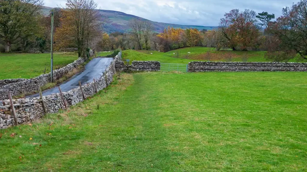
Walk to the gate at the bottom of the field, through a walled enclosure, and continue heading in the same direction (southwest). Soon, at a faint fork, keep right on the more obvious of the two grassy paths. Climb two stiles between fields. After the second stile, the path loosely follows power lines overhead.
After a gated stile, the path drops to a footbridge over Beldon Beck. Cross the footbridge and climb to a hand gate to your right. Head through the gate and continue down the path, arriving at West Bolton after two more gates.
Walk along the drive passing to the left of a short row of houses. Where the drive turns to the left beside farm buildings, keep straight ahead through a hand gate/stile and head uphill and through another gated stile.
Continue along this path, passing through two more gates. The path eventually joins a farm track. Head downhill on the track to East End Farm, then through the gate to the left immediately beside the stone wall to the main road.
Turn right along the road into the village of Carperby.
Carperby to Aysgarth Upper Force
Walk through the village of Carperby. As you approach the war memorial, directly opposite a bus stop on your right, turn left, signposted “Low Lane End 362 Yards”.
Pass through a gate ahead and walk down the field. The path curves to the right as it descends the field, heading through a gate on the stone wall on your right, approximately halfway down the field.
Head diagonally across the next field to a footpath marker post behind a section of a broken stone wall on the top of a mound.
Pass the marker post and walk alongside the stone wall on your left, to a gate leading onto the road. Turn left on the road then follow the main road as it turns to the right. Just after the right-hand bend, go through a hand gate on your right. Follow the footpath down the field, adjacent to the stone wall on your left. At a footpath junction, keep straight ahead through a hand gate.
The path passes to the right of a fenced-off group of trees and passes two disused stiles in Bear Park before heading down to an old metal gate. Head through the gate and climb to the old disused railway line above the Aysgarth Falls car park.
Continue straight ahead, down through the remains of another old metal gate, then bear left down the steps towards the car park. Bear right at the bottom of the steps and walk downhill on the surfaced path, past the car park on your left, and down to the bottom, to the right of Yore Bridge.
Keep straight ahead through the gate beside the bridge. Keep left passing through a double gate, and continue a few metres ahead to the Upper Force waterfall.
After visiting Upper Force, retrace your steps back through the gates to the path beside Yore Bridge and up the path back to the car park and visitor centre (or, if traveling by bus, turn right over the bridge and up the road into Aysgarth village)