A scenic walk along Welton Dale from the hamlet of Brantingham on the edge of the Yorkshire Wolds, following part of the Yorkshire Wolds Way and climbing to views over the River Humber.
Welton Dale Walk from Brantingham Overview
Distance: 7.5 Miles (12.1km)
Total Ascent: 1040ft / 317m
Time: 3hr 40m
Map: Ordnance Survey Explorer 293 (Kingston Upon Hull & Beverley)
Get this route on the OS maps website & app
This route on Komoot
The time is loosely based on Naismith’s Rule and will vary depending on the walker.
Getting There
By Car:
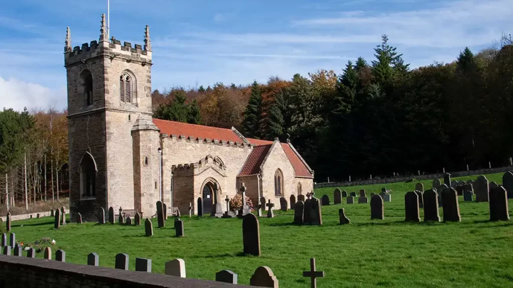
Roadside parking beside All Saints Church on Dale Road in the village of Brantingham (Some satnavs may describe it as in Brough), a few minutes’ drive from the A63 (Elloughton/Brough/Welton exit). Postcode HU15 1QN
Public Transport:
A bus service from Hull Paragon bus & rail interchange runs to the terminus at the village of Elloughton which is close to the route of this Welton Dale walk. From the East Yorkshire bus depot, walk to Main Street and turn left, passing Elloughton Church on your right. Follow Man Street up to a crossroads. Turn right up Main Street and follow it to the end of the road. Keep straight ahead to cross a pedestrian footbridge over the A63. Emerge onto Dale Road and keep straight ahead until a T-Junction. At the junction, to join the route, keep straight ahead on the Public Footpath
All Saints Church Brantingham to Turtle Hill
From the church walk down the road to the next driveway on your left. Turn left and pass through the gate signposted “Yorkshire Wolds Way”. Walk up the footpath between two fields and climb to a gate.
Walk through the gate and turn left up the minor road, still signposted “Yorkshire Wolds Way”. Pass a double gate and then a footpath sign on your right, but keep straight ahead up the road. Where the road turns left into the drive of Brantingham Wold Grange, keep straight ahead onto the unsurfaced track, passing two benches.
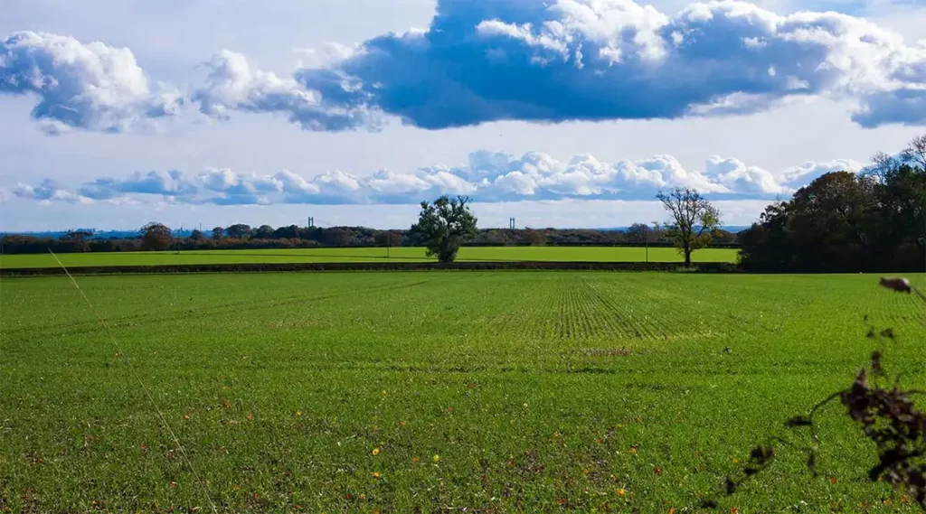
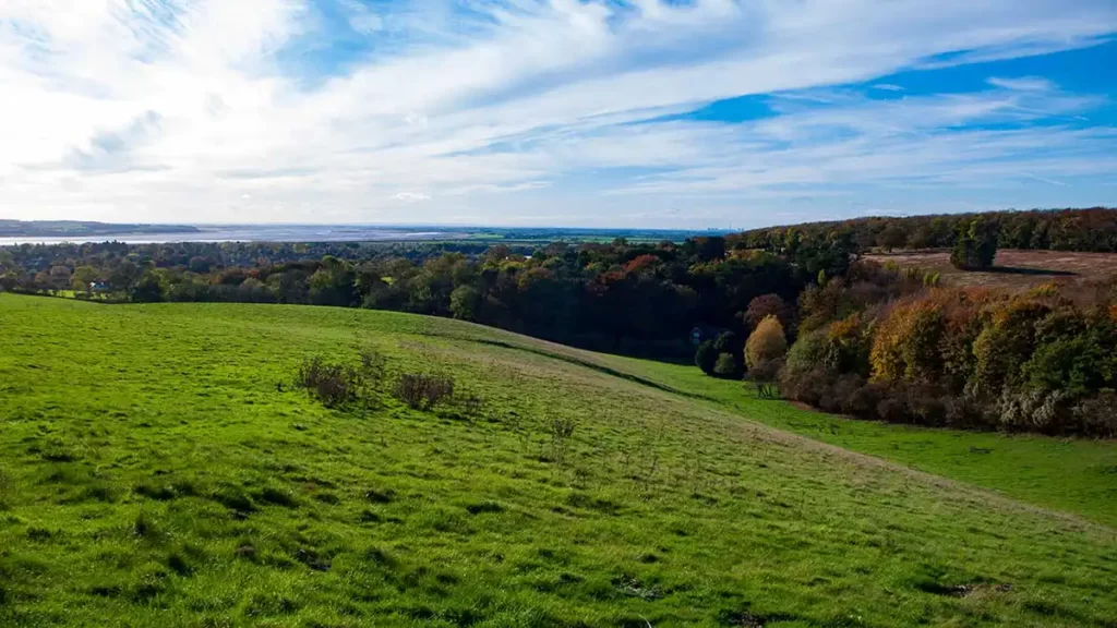
As you walk along the track, to your right over fields you can see the towers of the Humber Bridge and, on a clear day, farther along the Humber Estuary.
Keep walking straight ahead onto a gravel track until it reaches a road. Continue straight ahead on the road, still signposted “Yorkshire Wolds Way”. Head roughly in the direction of a wind turbine.
At a road junction, cross over and continue straight ahead through/beside a gate. Walk along the tree-lined path which continues towards the wind turbine, then sweeps gradually right before arriving at a path junction at Turtle Hill.
Turtle Hill to Welton Dale Walk

Turn right, still following the sign for the Yorkshire Wolds Way on the Public Bridleway. The clear track climbs slightly then bears slightly right at a tree. After swinging right again and then left, continue on the track to reach Wauldby Manor Farm. Turn left at the path junction, then right. Follow the bridleway along the right of the field until the very far end.
Pass through a gate and turn right down a path into a field. Walk along the left of the field, heading downhill to a gate on the left after a telegraph pole. Turn left, cross the drive and pass through the gate onto a wooded path.
Descend the path through the wood. Bear half left after passing a footpath signpost and head down the wide fenced path. Head through the gate at the bottom of the slope, into Welton Dale.
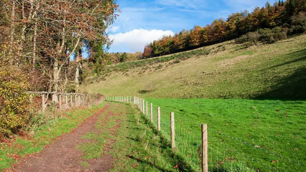
Walk along the bottom of the dale on the easy-going path. At the far end, head through a gate. Pass a house on the left and keep straight ahead, passing to the right of a mill pond along the track which becomes a tarmac drive heading out of the Welton Estate onto Dale Road in the village.
Welton Dale to Elloughton Wold
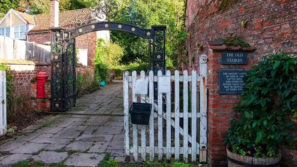
Pass the Old Stables on your left with the cattle well and overflow which is accessible just beyond the gate and continue along the lane to a junction by a white telephone box.
Turn sharply right at the junction up Kidd Road and climb up the road. Pass a junction and continue straight ahead up the hill towards Elloughton. Pass Ellooughton Hill farm on your left, after which, the road levels out. A number of benches on the right face towards wide views overlooking the River Humber, Elloughton, and Brough.
Continue along the road which soon begins to descend gradually. Just before reaching a road junction, take the right turn up a public footpath. A label on the sign indicates “Humberside County Council Circular Walk”, a throwback to the controversial and now disbanded county of Humberside.
(If you have travelled by Bus and followed the directions from Elloughton Bus Depot, pick up the walk from here)
Ascend the footpath which climbs fairly steeply to reach a viewpoint with two wooden benches. Behind-left the Humber can be viewed as it winds towards Goole.
Pass the benches and continue uphill through a hand gate. A little after the gate after heading into the woods, reach a path crossroads. Take the left path which descends slightly, then at another path junction with a small hump in the ground on the straight-ahead path, turn left. This path remains roughly at the same height for a while before it bears right and begins to descend. Follow this path as it snakes down to a road via a gate at the bottom.
South Wold Plantation to Brantingham
Cross the road and pass through the gate opposite. Follow the path which passes just left of a fence then heads gently uphill. Pass a gate to your right, bearing left to climb steeply uphill. At the top of the steep section, reach a footpath sign and turn right, signposted “Brantingham 1 Mile”
Follow the Brantingham path to reach a metal gate ahead. Immediately before the gate turn left, climbing up the footpath. Continue along this footpath through the plantation for a little over half a mile. Pass through a gate onto the road and turn left down the road for around 300 yards. Look out for the public footpath on your right through a gate, turn right and follow the path downhill back to Brantingham Church and the start.