From the pretty village of Hutton-Le-Hole walk along Hutton Ridge, then head off to visit Ana Cross, a round-barrow tumulus & monument, before heading across narrow sheep trods over Spaunton Moor to return to Hutton-le-Hole.
Basic navigational skills, a map & compass, or GPS (ideally both, tech can and does sometimes fail!) are essential on the return leg. The route follows narrow trods and groughs which are quite unclear in places, the line on the OS map is much of an approximation.
Ground Nesting Birds, Dog Walking & Easier Navigation Alternatives
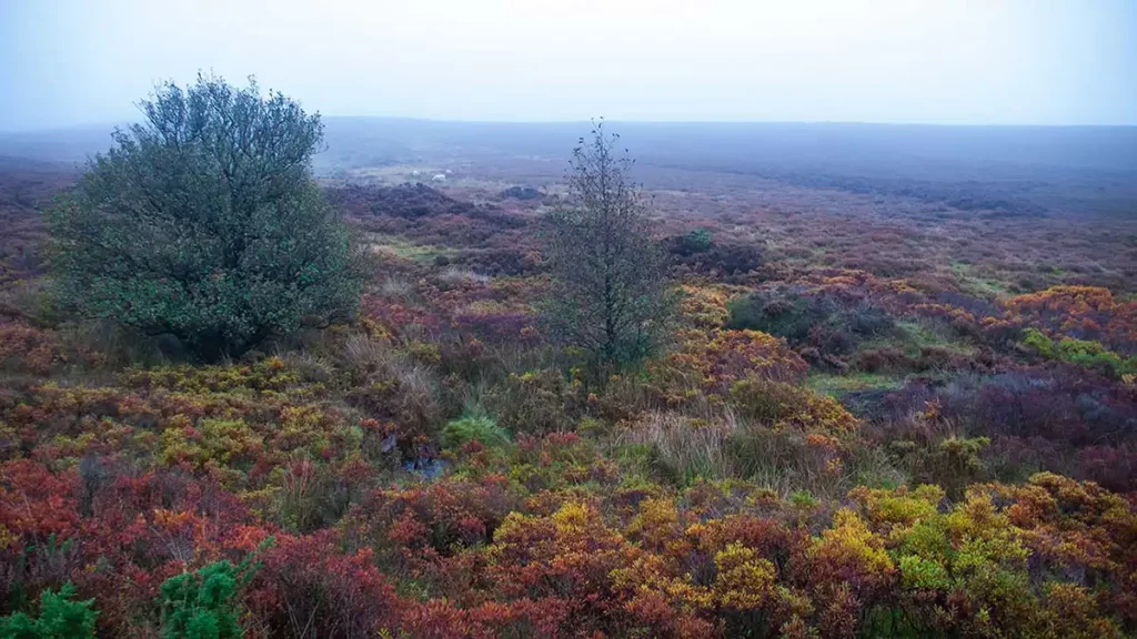
Some of this route on access land heads directly across moorland groughs and trods over the heather. To avoid disturbing ground nesting birds, use the suggested alternative sections if walking this route in nesting season (March-August). The access land on Spaunton Moor is also closed to dogs except on marked paths. Again, the alternative route suggestions allow this Hutton-le-Hole walk to be followed avoiding walking directly across the moors.
Ana Cross from Hutton Le Hole Walk Overview
Distance: 7.64 Miles (12.3km)
Total Ascent: 922ft / 281m
Time: 3hr 40m
Map: Ordnance Survey OL26 (North York Moors – Western area)
Get this route on the OS maps website & app
This route on Komoot
The time is loosely based on Naismith’s Rule and will vary depending on the walker.
Getting There
By Car:
Pay & Display Parking (Card Payment Only) in the village of Hutton-le-Hole. Postcode YO62 6UB. Toilet facilities in the car park are open in the daytime hours.
Public Transport:
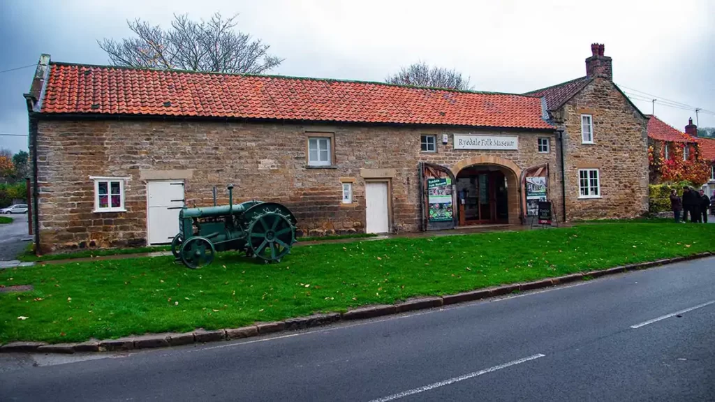
Traveling to Hutton-le-Hole by public transport is not quick or straightforward. Whilst there is a bus stop in the village opposite the Ryedale Folk Museum, a 2-minute walk from the start, it is served by a local bus from nearby Kirkbymoorside which in turn is a bus ride from Leeds or Scarborough.
Hutton-le-Hole Walk to Ana Cross
Exit the car park, turning right to head up the road. As the road turns to the right, turn left on a track heading to the rightmost of two gates. Pass through the gate and walk up the grassy track to the moors. Continue straight ahead as the path leads up through heather.
Where the path meets a metalled track beside a large rectangular stone block, turn left along the track for 1/4 mile. Where the track turns left take the unsurfaced track heading half right. Continue on up the obvious, but boggy in places, path, climbing gently up the moor. Pass a small tree to your right then shortly afterward, pass another small tree to your left.
Shortly after the second tree, the path crests the hill and then meets a track running left to right beside an old upright wooden post. Turn right and then follow the wide track which drops down Loskey Side to ford Loskey Brook before climbing again.

At a fork in the track, bear left and then almost immediately right down a narrower path to the right of a large pile of stones. Pass to the left of a fence that leads to a large stone enclosure, on a path through the heather.
Drop down to a brook and step across it (the brook is narrower a short way to the right) then follow the path as it works its way over the moor and the heather, to emerge onto a road.
Alternative Route 1
To avoid the moorland groughs, take the right option at the fork in the clear track and follow the track up to a gate onto the road further to the right, and turn left along the road to meet up with the route again)
Turn left along the road and follow it until a track crosses the road at the summit of Chimney Bank. A road sign warns of “Dangerous Hill Ahead”. Chimney Bank/Rosedale Chimney is a steep road (the joint-steepest road in England) that drops down from this point to Rosedale Abbey and is a popular challenge for cyclists.
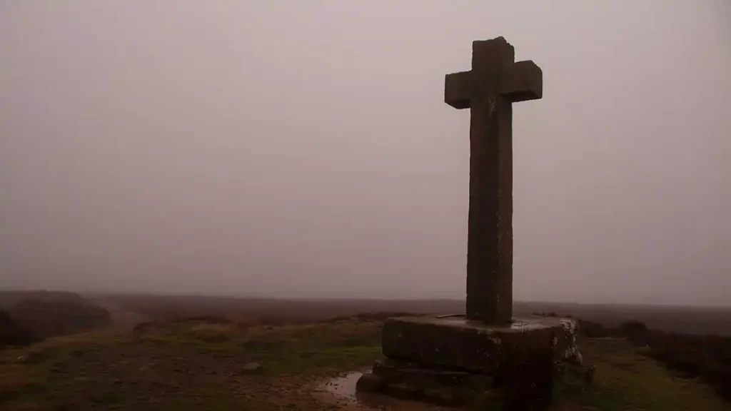
Turn right along the wide track. After a while, the monument of Ana Cross comes into view over to your right. At a crossroads in the track, turn right and walk to the monument.
Ana Cross to Spaunton Knowl
Ana Cross is a 19th-century monument that had fallen and was re-erected in the 1940’s and 1990’s. Previously known as Ain Howe Cross, the current wayside cross replaces a Norman cross which once stood taller on the site. The original may have been a sanctuary cross, giving church sanctuary for fugitives passing the marker.
Pass the cross on your right and remain on the track heading south. The track descends a little and passes a small cairn on your right. Shortly after the cairn, arrive at a junction. Turn right, still descending on the track for approximately 80 metres. At another small cairn on your right, turn right along a narrow grough path which may be wet underfoot.
Alternative Route 2
Instead of turning right onto the narrow path, continue along the main track and follow it south. Stay on the track along Lastingham Ridge as it gently curves to the left and drops down the moor to emerge on a minor road at Lastingham Grange Hotel Walk down the road to a junction and turn right along Front Street. Follow Front Street and turn right in front of the Church of Saint Mary. Walk past the Blacksmith’s Arms on the right on Anserdale Lane and keep along this road until you reach another road junction with an old-fashioned black & white striped signpost. Turn right, down to a road bridge. Cross the bridge, after which a track joins from the right. Continue the walk directions from the section “High Cross Plain to Hutton-le-Hole”
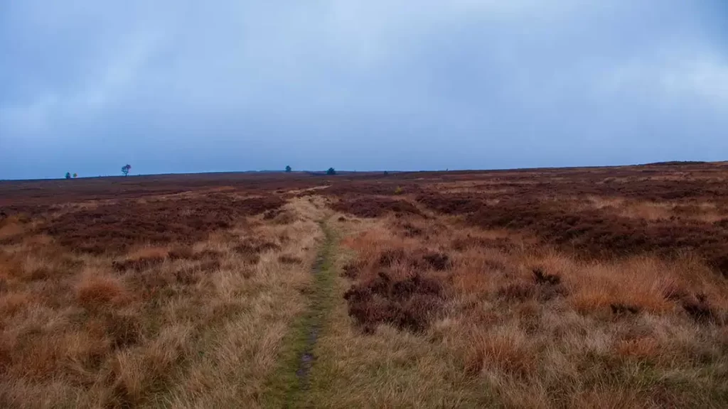
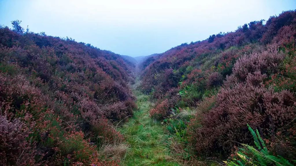
Continue along the narrow track, keeping straight ahead where another narrow track bears off half-left. Proceed with care as the track is uneven underfoot and partially obscured by heather. Follow the narrow grough path, bearing southwest. At this point, your map & compass, and/or GPS will become essential tools to confirm that you are heading in the correct direction over the moors, as sheep trods and gaps in the heather spread across the terrain.
The route descends steadily and gradually turns towards the right as you approach Hole Beck.
Cross Hole Beck and climb up the opposite bank, bearing half-left after a gorse bush to your right and climbing up Spaunton Moor and continue bearing roughly 195° south-southwest. Pass a 3-foot tall standing stone with other stones to the left and continue following the path.
The path becomes indistinct as you cross a marshy area with reedy grasses. Continue bearing in the same direction and you will pick up the path after leaving the marshy area.
As Spaunton Knowl comes into view, you will at first be heading straight towards it or slightly to its right. Your route bears to the left here as the path disappears again. Your route heads towards the left of the summit of Spaunton Knowl, climbing close to, but not quite up to, the top.
Spaunton Knowl to High Cross Plain
As you walk to the left of the Spaunton Knowl, an easier-to-follow path runs along the bottom of a 7′ deep trench (if it is not too wet). This path then climbs up out of the trench to the right and then follows a shallower trench down to a track.
Cross the track and keep straight ahead on the grough path. A line of wooden grouse butts heads off diagonally to your left. Pick your way through trods as you descend the moor. As you get closer to the bottom of the moor and approach marshy ground, aim slightly left heading towards a small group of trees near the end of a stone wall.
When you reach a clear path by the wall and trees, turn right and follow the path down to a gate. Head through the gate and to the road. Turn right onto the road.
High Cross Plain to Hutton-le-Hole
Walk up the road, passing farmhouses and buildings on your left. Ignore a public footpath on the right between gorse bushes. Instead turn right up the farm drive just after the footpath.
Arrive at the farm buildings at Bainwood Head and turn left, walking downhill, beside a stream briefly. As the stream heads off right to a gate, continue straight ahead downhill. Cross two wooden footbridges and bear right up the path through bracken to the road.
Cross the road and turn half-right to head up the footpath which gently climbs away from the road. Pass through a gate into a wooded path and descend to cross a footbridge.
Across the bridge and through the gate, keep straight ahead, walking along the left of a fence. Continue into the next field and immediately bear half-right, staying to the right-hand side of the field. After passing a gate on the right, again keep to the right of the field beside a fence, to reach a hand gate at the far right-hand corner.
Continue through the gate and keep staying to the right and emerge into the backyard of The Barn tearoom in the village. Walk to the road, and turn right along the road past the Ryedale Folk Museum to the road junction. Turn right again and return to the car park to conclude your Ana Cross from Hutton-le-Hole walk.