About This Walk
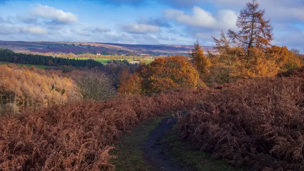
This scenic Goathland Waterfall Walk circles around the village of Goathland, between Pickering and Whitby on the east North York Moors. Following Eller Beck and West Beck the route takes in four waterfalls including Thomason Foss at Beck Hole, the tall, popular Mallyan Spout and the lesser visited Nelly Ayre Foss, with an optional scramble down to the bank of West Beck.
Returning around the east side of Goathland, the first and final sections of the walk roughly follow alongside the line of the North York Moors Steam Railway, with plenty of chances to view passing steam trains either at Goathland Station or along the line.
Distance & Elevation
Distance: 8.33 Miles (13.4km)
Total Ascent: 1593ft / 485m
Time: 4hr 10mins
The time is loosely based on Naismith’s Rule and will vary depending on the walker.
Traveling by Car:
Pay & Display parking with toilet facilities on Beck Hole Road, Goathland YO22 5LX
Traveling by Public Transport:
Goathland is served by the York & County Coastliner service 840 from Leeds / York / Scarborough / Pickering stops at the shops in Goathland Village
Ordnance Survey Map & App
Map: Ordnance Survey OL27 (North York Moors – Eastern Area)
Get this route on the OS maps website & app
Komoot
Goathland to Darnholm and Railway Bridge Weir
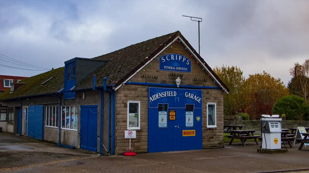
Begin your Goathland Waterfall Walk by exiting the car park in Goathland to the T-junction and turning left along the road. Pass Aidensfield Garage, and the Goathland Hotel and walk down to Goathland Railway Station. Fans of the TV show “Heartbeat” will recognise the garage and funeral services from the fictional village of Aidensfield. The Goathland Hotel also featured regularly as the “Aidensfield Arms”
Descend the road to the train station which is part of the North York Moors Steam Railway. Goathland Station was also featured in the Harry Potter films as Hogsmeade Station. In peak season the village may be quite busy, but if crowds aren’t your thing, don’t worry – we soon leave the TV & Film sets behind.
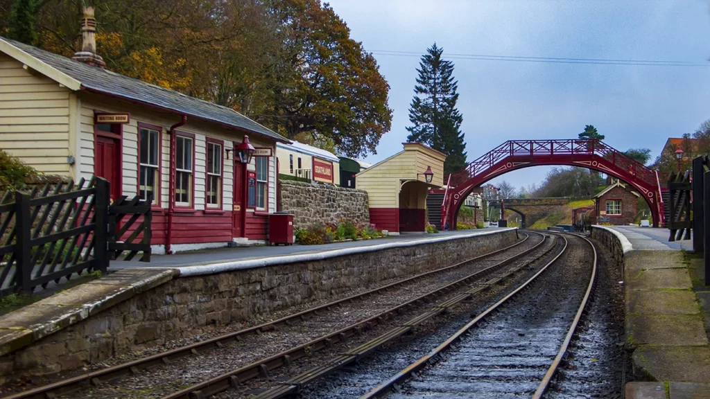
Cross the railway lines by the crossing (or over the footbridge if trains are in the station), go through the gate opposite then turn left up the footpath signposted “Darnholm”
A fence on your left becomes a stone wall as the path starts to level out. The path heads along Mill Scar, then soon drops steeply down steps with the railway line to your left.
At the bottom of the steps the path bears slightly to the right and over a footbridge towards a farmhouse. Pass to the right of, and behind, the farmhouse and stone wall. Past the farmhouse, join the drive briefly until it turns to the left. Here, head right toward the steps in the hillside.
Cross a wooden footbridge and climb the steps, passing a bench and continuing up the obvious, steep, path.
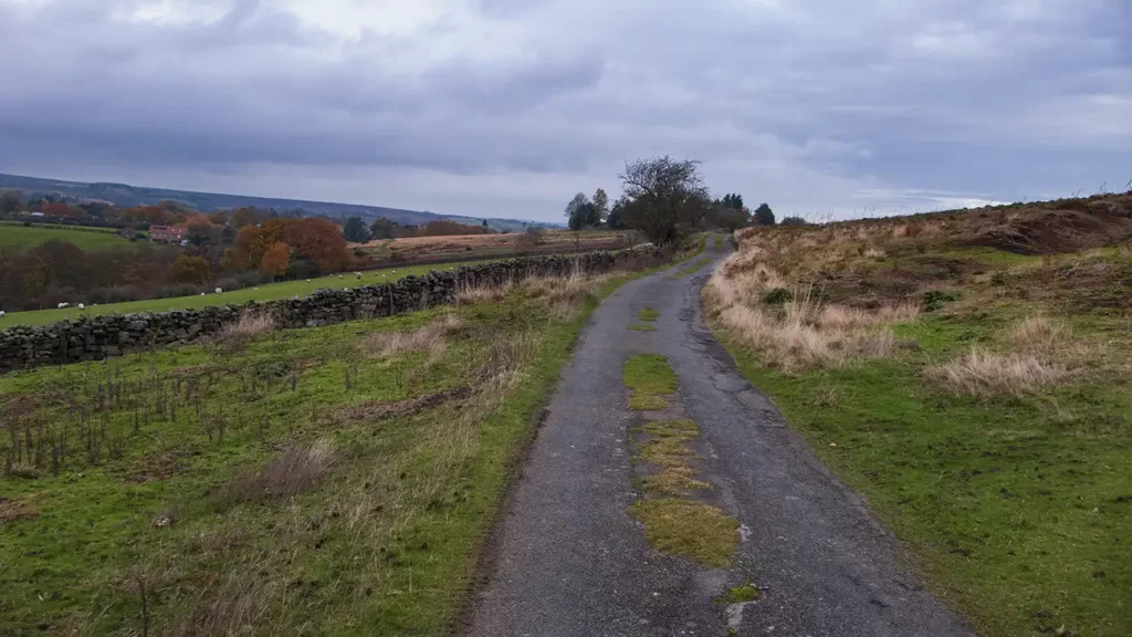
At the top of the steep climb, reach a footpath crossroads. Turn left over a stile and walk alongside the wall on your left to reach a clear track. Keep straight ahead on the track, past a farmhouse and through a gate beside a telegraph pole.
Step over a ditch, and continue along the moorland path with the village of Darnholm over to your left. Where the path forks, bear left.
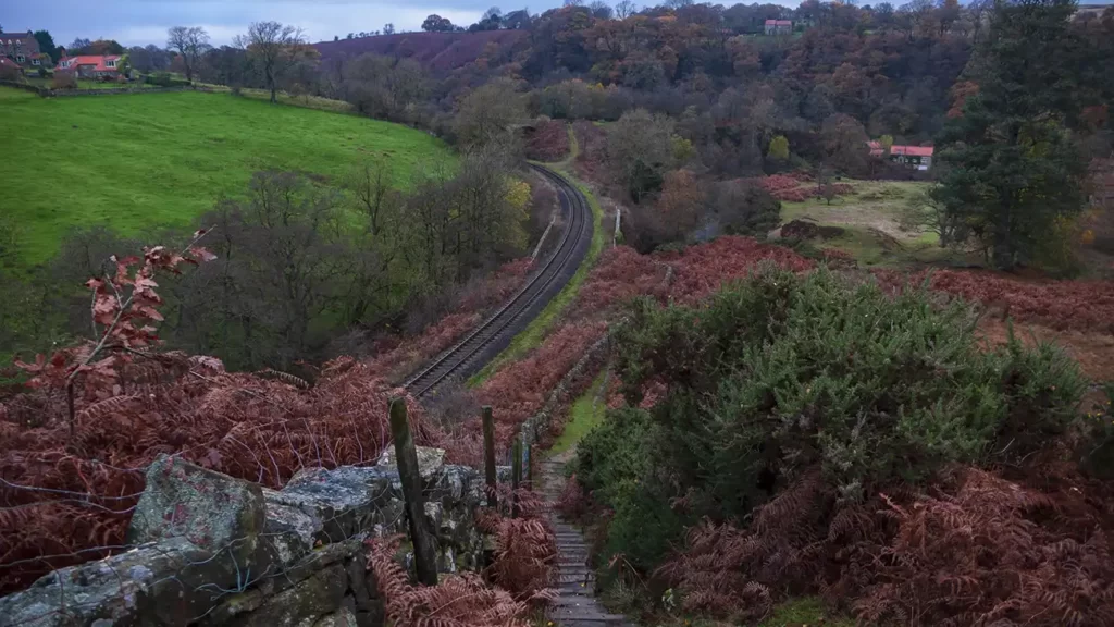
In a short while, a small grassy viewpoint in the bracken on the left overlooks the first of the waterfalls along the walk in the beck below, with the railway line beside it.
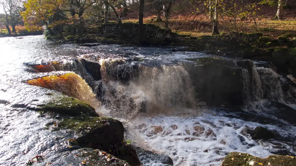
Continue to a footpath junction, then turn left to drop steeply down a path to the railway line. Descend carefully as the path heads straight down the steep hillside. Drop to a footbridge that passes under a railway bridge, with the beck below rushing through a small weir.
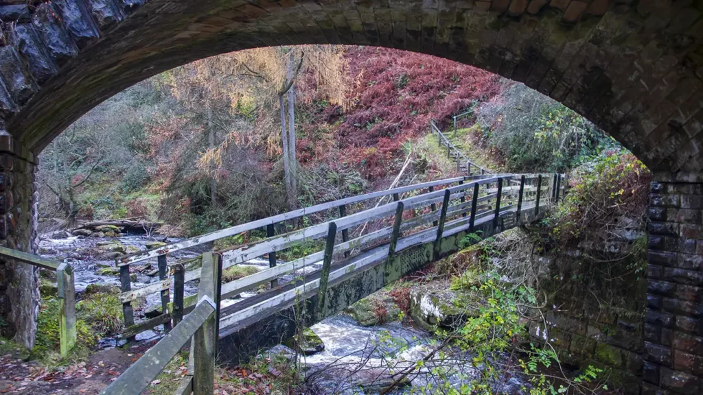
The water rushes under the bridges as it heads towards nearby Thomason Foss, your next destination.
Beck Hole & Thomason Foss
Do not cross over the footbridge. Instead, turn right up the path alongside the wooden fence to climb back up the moor. The path climbs gradually with the beck to your left.
At a bench beneath a tree, turn right and follow the path with trees to your left. Pass Lins Farm on your left and continue along the farm track ahead to reach Hill Farm. At Hill Farm, turn left down the drive and descend to a road beside a bridge.
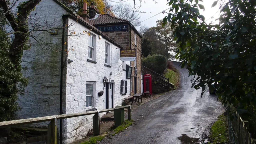
Turn left along the road, over the bridge and follow the road down to the small village of Beck Hole.
Just before reaching the road bridge, head left up a sloping path signposted “Thomason Foss Waterfall”.
The path climbs briefly up to the railway line then descends steps back down to the beck. Follow the waymarkers along the bank to reach Thomason Foss Waterfall.
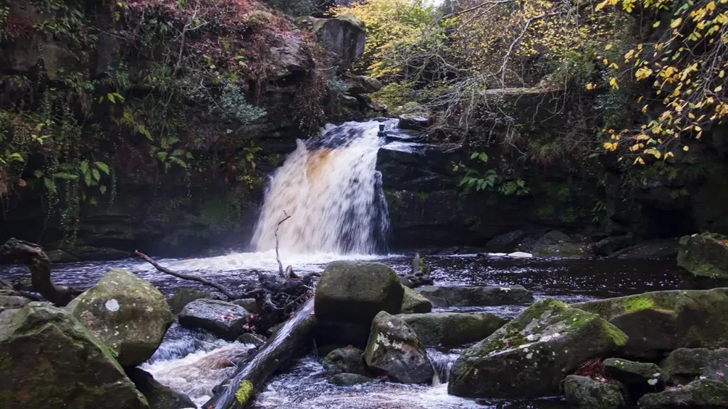
After visiting the waterfall, retrace your steps along the beck, and back to the road at Beck Hole.
Beck Hole to Mallyan Spout
From the Thomason Forr footpath, cross the road and take the Public Footpath opposite, alongside White House, signposted “Public Footpath, Murk Esk and Rail Trail” and through the gate. Walk beside the beck to a path junction. Turn left, signposted “Rail Trail Goathland 1 Mile” and cross the footbridge.
At the next footpath junction keep straight ahead on the rail trail then turn right just before Incline Cottage on the path signposted “Mallyan Spout”
Head through two gates then climb a steep flight of steps. At the top of the steps, head up the clear path through two more gates and continue along the footpath between fences on either side.
The footpath runs level for a while then descends slightly right down a flight of steps before leveling out again. Continue along the path as it gradually makes its way down a set of stone steps, over a footbridge, and soon down more steps to a gate and a footbridge.
Cross the footbridge and walk along the wooden walkway. At a footpath junction, continue straight ahead beside West Beck, signposted “Mallyan Spout 130m”
The path becomes a slight scramble over rocks as it approaches Mallyan Spout which tumbles down from above to your left.
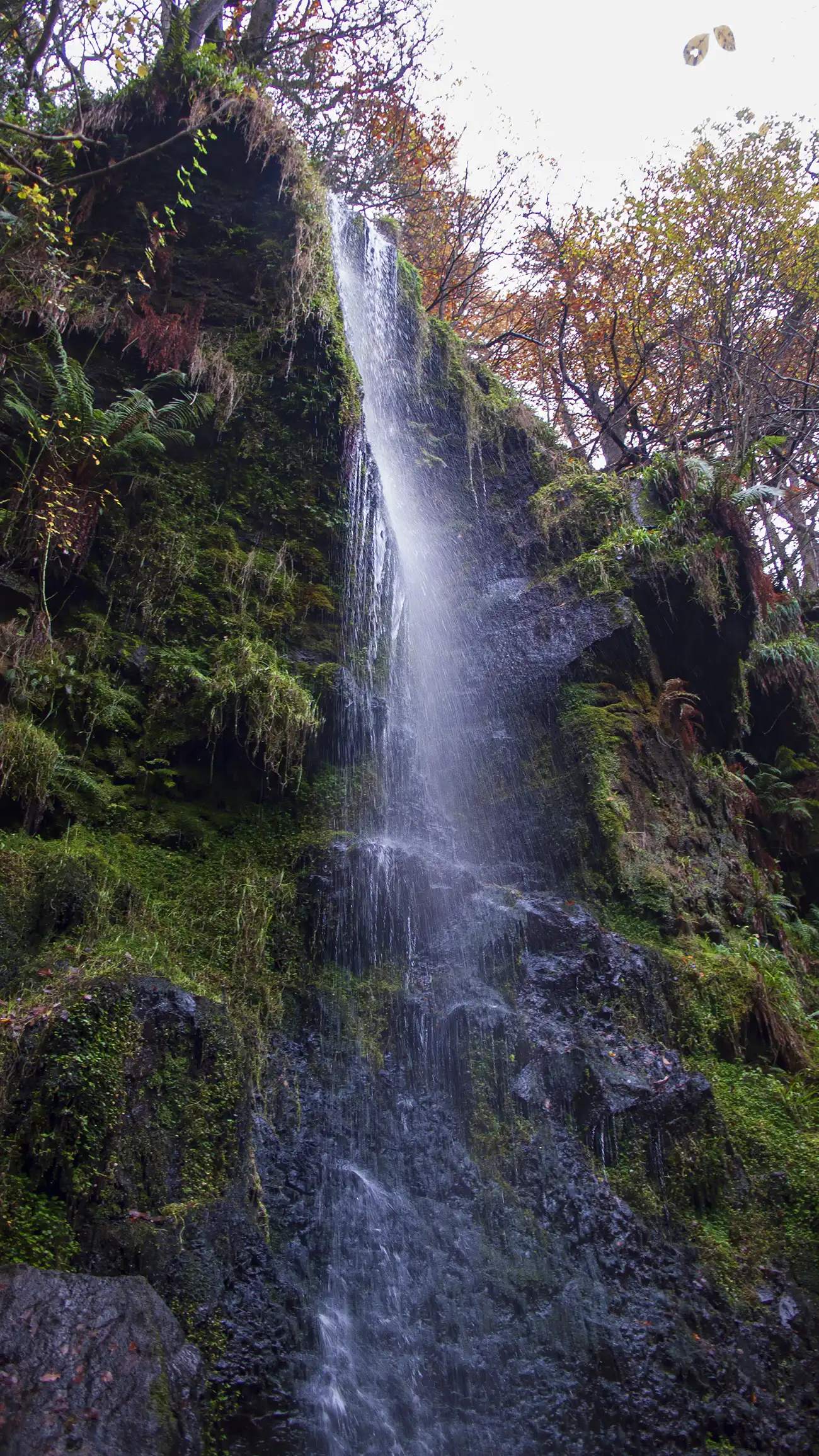
Walk below the waterfall and up the steps. Head along a wooden platform then drop down wooden steps to continue walking alongside West Beck. Cross the beck twice over footbridges and continue along the bankside until you cross a stile, climb steps and reach a path junction.
The path along the beck farther along is suffering from erosion and a sign placed at the junction requests that you use an alternative route by a permissive path, which takes you up to New Wath Scar.
Mallyan Spout to Nelly Ayre Foss
At the path junction. turn left and climb the steps that ascend steeply up New Wath Scar, high above West Beck. At the top of the steps, rear right under a tree along the waymarked permissive footpath.
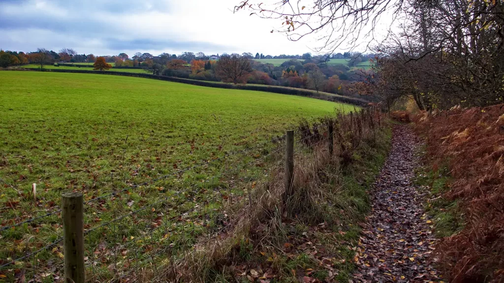
The path continues to climb across New Wath Scar and then heads along the ridge with the back far below to your right and views over woodlands and moorland.
Follow the path as it meanders roughly towards a minor road to your left. At a gate close to a telegraph pole, go straight ahead through the gate and descend the path with a stone wall to your right. The path reaches a road. Cross over the road and walk along the drive opposite, toward New Wath House.
Pass beside New Wath House through the gate signposted “Nelly Ayre Foss” and climb the path steadily up the moorland, roughly following the line of the telegraph poles. Keep straight on beside stone walled fields to your right.
After the stone wall ends on your right, turn right to walk downhill with the field and fence to your right. Turn right again at the bottom end of the field and walk beside the bottom fence for about 13 metres to a steep path down to your left through ferns and bracken. The path down may be slippery and is steep for the first few metres then eases off as it drops about halfway down to Nelly Ayre Foss waterfall below.
The waterfall can be viewed from this point. If you wish to descend all the way down to the waterside, you can scramble down beside the fence down to the water. You should be aware that although the scramble is not technically difficult, it may be slippery, There is little to arrest a fall before reaching the weir. If you do scramble down, use extreme care. (A walking pole, retracted, is a useful aid to scrambling down)
From Nelly Ayre Foss, retrace your steps back to the field corner and stone wall near a lelegraph pole.
Nelly Ayre Foss Waterfall to Mallyan Spout Hotel
At the corner of the field, turn left and walk back alongside the field until you reach a field gate on your left. Beside the gate, turn right, up the moor. Take the left of the two path options and climb to the road.
Turn left and walk along the road for approximately 140 metres. When you reach a roughly-square stone to the right of the road, bear half-right up the moor. Follow a faint path just to the left of, and following, the line of, a ditch.
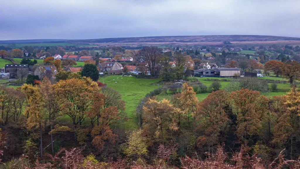
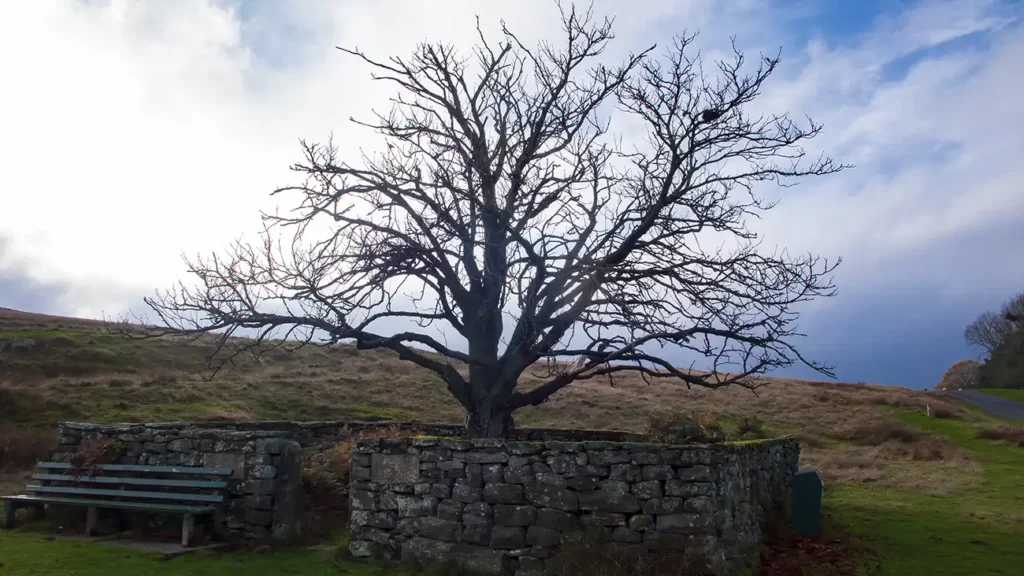
Continue up beside the ditch until you reach a clearer well-trodden path and bear left. Go straight ahead at a path crossroads and continue along the path (public bridleway) until you reach the edge of Goathland village. The bridleway passes beside a tree in a stone enclosure. The tree was planted in 1935 to commemorate the Silver Jubilee of King George V
Bear left at the roundabout and walk along the road towards the village passing St. Mary’s Church on your right and Mallyan Spout Hotel on your left.
(If you are tiring at this point you can continue along the road through the village, turning right at the next junction to return to the start. All the Goathland waterfalls have been visited. To complete the full circuit around the village continue on to the next stage)
Mallyan Spout Hotel to Goathland Station
After passing the church, turn right at a footpath sign, marked “Centenary Walk”, onto an unsurfaced drive. Follow the drive around to the left and then through a gate ahead into a field.
Walk along the left of the field, through another gate and along the footpath with a fence to your left and a stone wall to your right. Follow this path over wooden walk boards and through several gates, cross a footbridge and pass through another gate into a field of the Abbots House Farm campsite.
Walk along the drive to exit the camping field and keep straight ahead at a junction, signposted “Public Footpath Abbot’s House”. Follow the vehicle track which becomes a tarmac road as it drops to pass beneath a railway bridge.
After the bridge, bear left past the farmyard and then head toward a footbridge to the left. Cross the footbridge and continue through a gate, keeping straight ahead. Cross another footbridge and then walk up along the left-hand side of the ditch, passing Goathland House farm on your left. Climb a stile and keep straight ahead, still climbing until you reach a minor road by a Public Footpath sign.
Turn left along the minor road and follow it to a junction. Turn left on the road, cross over and then bear right toward a driveway. Head toward the drive then turn left before the gate, following the public footpath which passes beside the houses and curves slightly right.
When you reach a bench beside a fence and stone wall, walk downhill immediately right of the wall. The path and wall drop steeply downhill behind Goathland Station.
At the bottom of the descent, turn left through the gate into the station. Cross the tracks and exit up the road, back to the Goathland Car Park and the start.