York City Walls Walk Overview
A classic walk around the city walls of York, the longest stretch of remaining, intact, city walls in England. Beginning close to Clifford’s Tower, the keep of the old York Castle, the route follows a counter-clockwise direction around the city walls with many opportunities to stop and explore parts of the city.
To begin the walk, take the Park & Ride bus service from Askern Bar, as after completing the circuit of the city, the route then follows the River Ouse South, leaving the city and following riverside and village paths to return to the Park & Ride car park
Distance: 7.41 Miles (11.9km)
Total Ascent: 162ft / 49m
Time: 3hr 5mins
The time is loosely based on Naismith’s Rule and will vary depending on the walker, and especially on this walk, the time taken exploring various points of the city.
Directions
York Park & Ride to the York City Walls Walk at Fishergate Bar
From Askham Bar, take the Park & Ride bus service into York, staying on the bus until the final stop at Cliffords Tower. As the walk takes you back to the Park & Ride car park, you will only need a one-way ticket into York.
After alighting the bus, cross the road towards Clifford’s Tower opposite. Turn right along Tower Street, passing the roundabout with the memorial obelisk. The road crosses the canalised River Foss to a junction on the left. At the junction, head through the archway ahead-left then turn right, up the steps onto the walls at Fishergate Tower.
Follow the wall as it heads to and around the corner, then drops down to Fishergate Bar
Fishergate Bar to the Red Tower
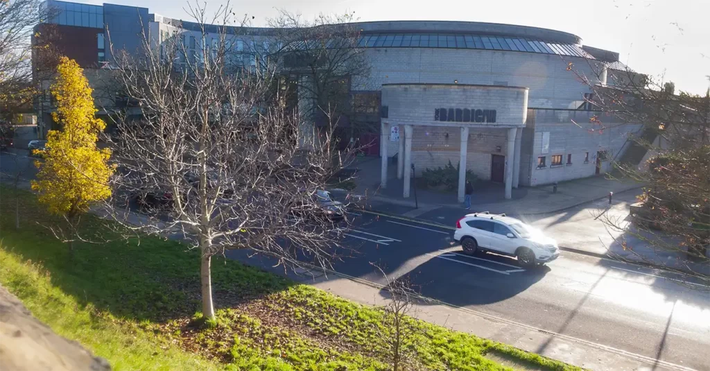
Cross the small road and climb up the steps on the opposite side to continue along the wall, the York Barbican Theatre on the right. With the busy streets and takeaways below it is hard to imagine the original view from the city walls.
Continue along the wall until you drop down to street level again at Walmgate. A coffee shop at the gatehouse gives an optional refreshment stop if desired.
Cross the road and head back up to the walls, continuing along the wall top with a road to your right and housing to your left, as the wall steadily drops down to the Red Tower.
Red Tower to Bootham Bar
After the Red Tower, there is a gap in the surviving sections of the wall, and the route joins the road for a while. Follow Foss Islands Road – the River Foss soon comes in from the left to run alongside the footpath. Pass the closed off metal footbridge of Monk’s Bridge.
Continue alongside the road until the junction at Layerthorpe Bridge. Cross the bridge then cross over the road to the walls.
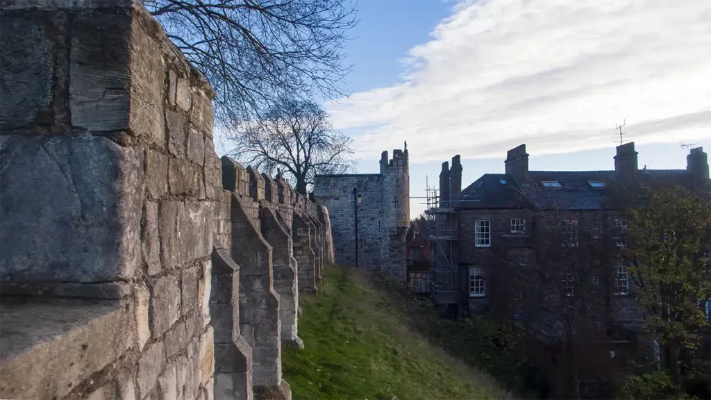
Follow the walls to reach Monks Bar where steps drop down to the street level. Cross the road under Monk’s Bar and head up the narrow staircase heading up inside Monk’s Bar (Signed “Richard III Experience”).

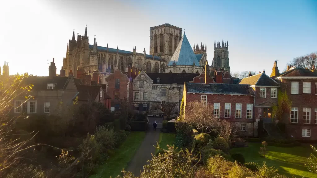
Join the walls again which climb upwards as York Minster comes into view. The walls pass behind the Minster then turn left to skirt behind the Minster.
The wall path narrows as it approaches Bootham Bar, dropping into the gatehouse then down to the road.

There is a WC near the Bootham Bar exit and a cafe for refreshments. If you wish to visit the York Art Gallery opposite, you do need to pre-book tickets at a time slot which may make combining this with a walk logistically challenging.

Bootham Bar to York Museum Gardens, Cenotaph & Railway Museum
After Bootham Bar, cross the road towards the museum and head left. Walk up the driveway to the left of the Kings Manor House and below the walls to your left, into York Museum Gardens.
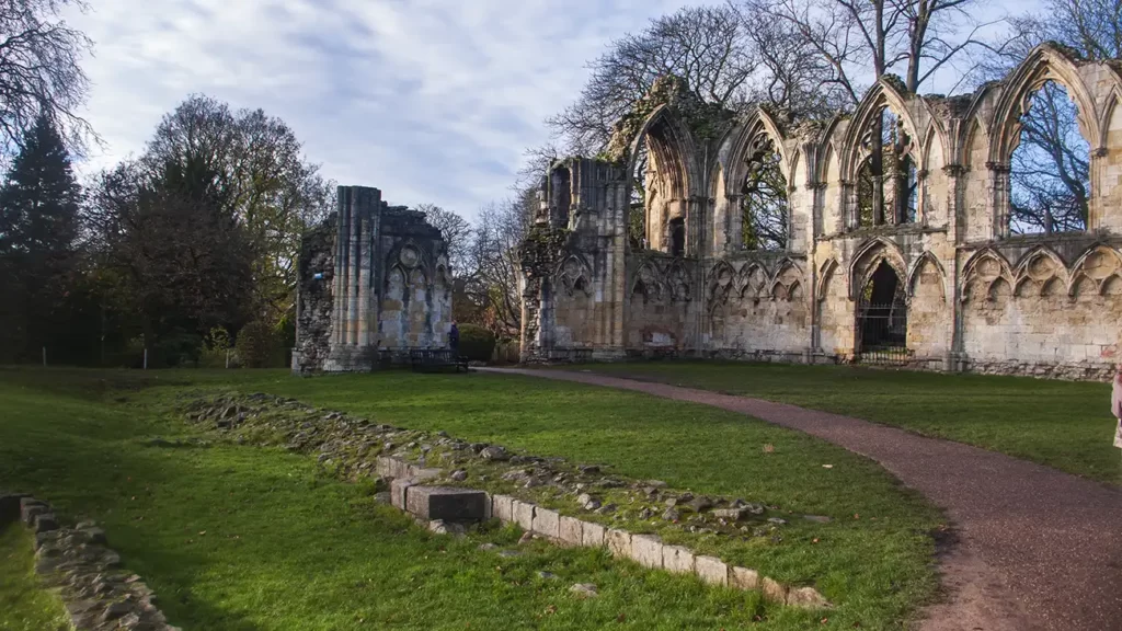
Explore the museum gardens, a botanical garden housing the ruins of St Mary’s Abbey and more; it is worth taking some time to wander around and, on a nice day if you are carrying a packed lunch, makes a good picnic stop along your walk.
After exploring the gardens, leave the gardens heading towards the bridge, with the Multi Angled Tower on your left. On leaving the gardens head right along the roadside path across Lendal Bridge.

After crossing Lendal Bridge, re-join the York City Walls and pass the cenotaph below
Cenotaph & Railway Museum to Baille Hill
Beside the cenotaph, if you wish to make a visit to the York Railway Museum you can leave the walls just past the cenotaph, via a flight of stairs heading towards the railway station and museum. Note that just like York Museum, the National Railway Museum also requires pre-booking of tickets and careful planning may be needed to time your walk with your ticket time slot.
If you have travelled to York by train or bus, you can join the walk here. Climb the steps to the walls opposite the railway station and turn right
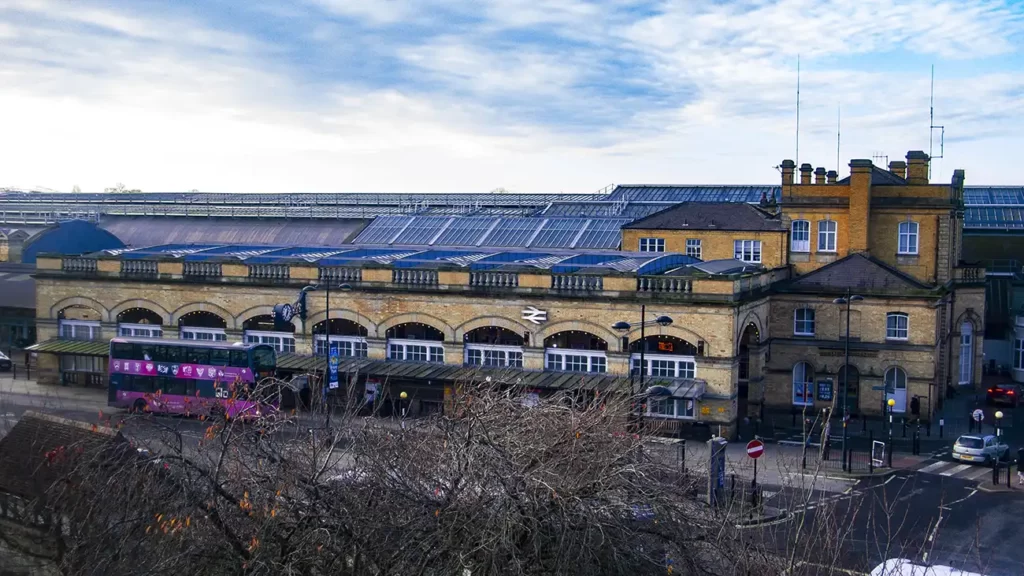
Walk along the walls with the train station below to your right, to eventually reach Micklegate Bar. There is no need to drop all the way down to the street level, you can cross over inside Micklegate Bar.
As you walk on from Micklegate Bar, looking right over the York rooftops to your right, you may see the clock tower of Knavesmire at the York Racecourse in the far distance. As the wall turns left again, you will see Clifford’s Tower come into view ahead.
Continue towards Clifford’s Tower along the wall until the steps drop down to Baile Hill, the site of a Norman Motte & Bailey castle.
This completes the circuit of the York City Walls Walk. If you are spending a day in York and wish to explore the city further, this is an ideal spot to head into the town to walk around, seek refreshments or even do a spot of shopping, if you have room in your walking backpack! The next stage of the walk leaves the city and heads along the River Ouse and back to the park & ride car park.
Returning to the Park & Ride: Baille Hill to Millennium Bridge
From the exit at Baile Hill, head across Skeldergate Bridge to cross the Ouse. After crossing the river, turn left down steps and then left again to walk underneath the bridge to follow the River Ouse on your right.
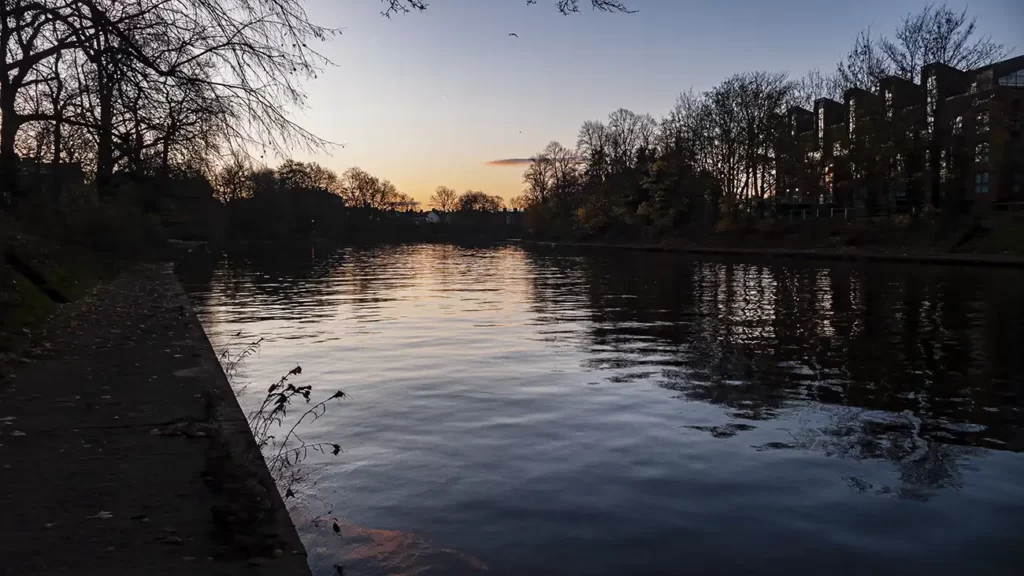
Walk beside St George’s Field car park on your left – you can either walk along the higher path or the towpath beside the river. The towpath may be muddy in places.
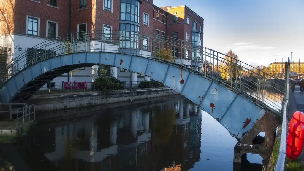
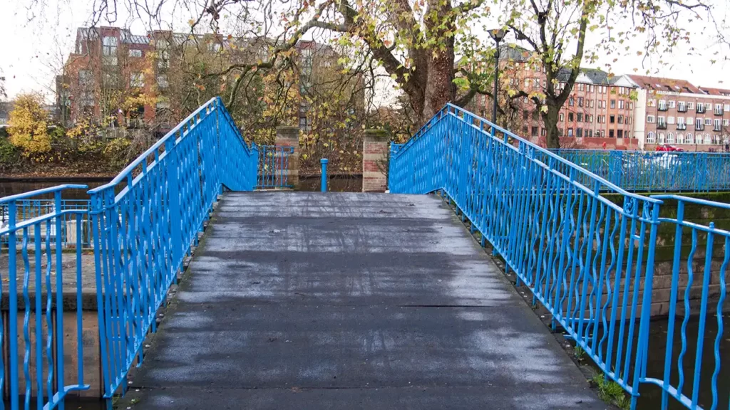
After the car park, the path turns left over Blue Bridge which crosses the mouth of the Foss. Blue Bridge is an old lifting footbridge dating from 1895. The bridge is rarely raised especially since the Foss was made into a canal
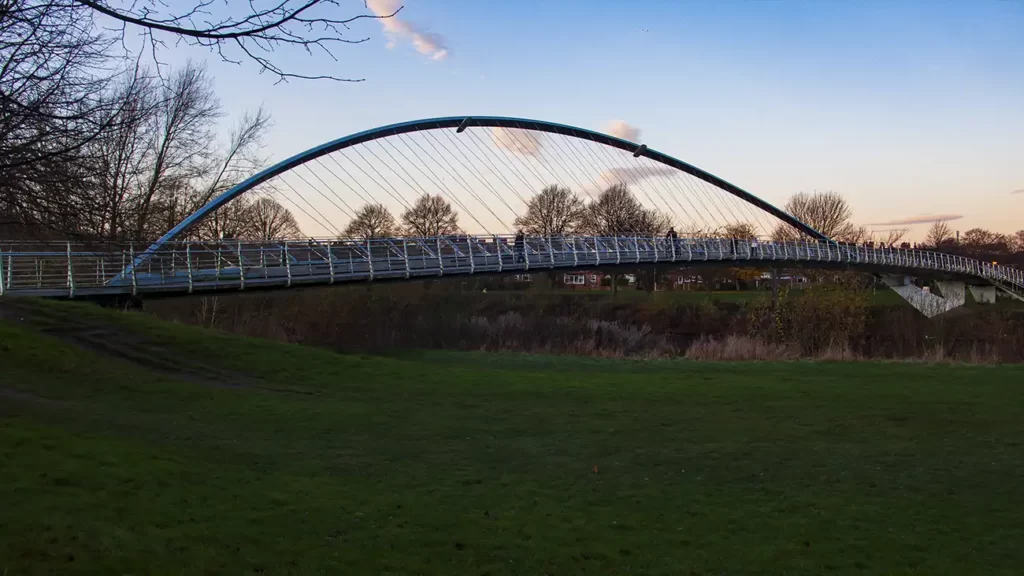
Cross Blue Bridge and continue along beside the Ouse until you reach Millennium Bridge. As the name implies, Millenium Bridge is a modern bridge with a design inspired by the spokes of a bicycle wheel. The bridge is a foot and cycle path uniting the east and west suburbs of York south of the city.
Cross Millennium Bridge. When across the river, take the steps down to your right then turn right again at the bottom of the steps to continue along the river.
Millennium Bridge to the Solar Way Path
Now with the river on your left, continue heading south. Where a paved path turns off to the right, signed “Trans-Pennine Trail” instead keep straight ahead on the unsurfaced path beside the river.
After a short while, climb over a stile and continue alongside the Ouse. You can now see the clock tower of Knavesmire and the York Racecourse to your right.
Keep following the riverside footpath. Shortly after crossing another stile, the path and river begin to sweep around to the right.
After the right hand bend, cross another stile and pass beneath a road bridge which carries the busy A64 Leeds-York-Scarborough road. After crossing another stile, the path bears slightly right, leaving the Ouse and passing behind the crematorium memorial garden.
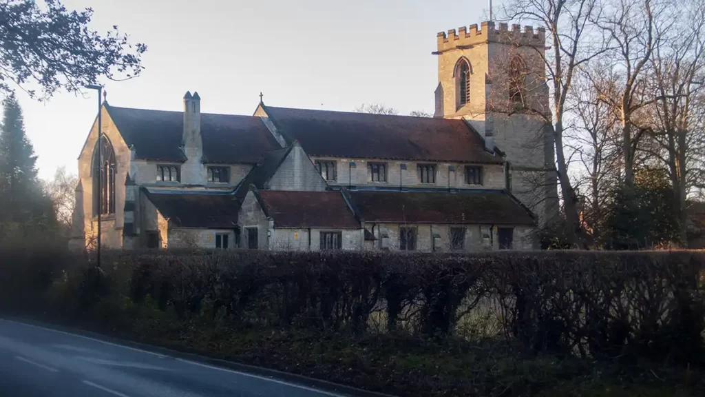
Emerge at a road (Bishopthorpe Road) and turn left alongside the road. Pass St. Andrew’s Church on the right then Bishopthorpe Palace on your left. Follow the road around to the right.
Cross over Acaster Road on the left and continue along Main Street, passing Bishopthorpe Village Hall on your left.
As the road turns slightly left, turn right up Copmanthorpe Lane, with Bishopthorpe Methodist Church on your right. Continue along Copmanthorpe Lane until you reach the end of the cul-de-sac for vehicles.
York Solar Way to Askham Bar Park & Ride
Where Copmanthorpe Road turns left onto Appleton Court and the road ends, turn right along the Trans-Pennine Trail, signposted “York 4 Miles”.
Follow the tarmac bridleway of the Trans-Pennine Trail along the Solar Way. You will pass models of the planets in our solar system which line the path. As you are joining the Solar Way part way along, you will not see the most distant planets. The Solar System Trail can be a complete walk on its own.

Pass Mars, the Earth and Moon and Mercury. Eventually you will pass beneath a road bridge, then a model of the sun. At the sun, keep straight ahead and pass White Rose Park to your left.
Pass under the next road bridge and follow the path as it spirals up to the A1036, then turn right to head to the Park & Ride Car Park and the end of the walk.
If you arrived at York via train or bus and joined the walk near the railway station, you can still take the park & ride bus back into York city and continue around the walls walk.