This Redmires reservoir walk, around a mixture of pastoral farmland and the three Redmires reservoirs, begins at Lodge Moor on the outskirts of Sheffield before heading out to skirt the three reservoirs before diverting alongside Redmires conduit above the Rivelin tunnel, then heading over moorland to a small neolithic stone circle
Redmires Reservoir Walk Overview
Distance: 6.45 Miles (10.4km)
Total Ascent: 603ft / 184m
Time: 3 hr
Map: Ordnance Survey OL1 (The Peak District – Dark Peak Area)
Get this route on the OS maps website & app
The time is loosely based on Naismith’s Rule and will vary depending on the walker.
Getting There
By Car:
Considerate roadside parking on Blackbrook Road, off Redmires Road (postcode for satellite navigation S10 4LQ, bearing in mind that it is a residential road with access required to driveways and homes
Public Transport:
Bus service number 51 from Sheffield City Centre (First Bus), alight on Redmires Road at the corner of Blackbrook Road
1. Lodge Moor to Brown Hills Lane
Begin the Redmires reservoir walk from your parking spot or the bus stop by walking south along Blackbrook Road. Pass St. Luke’s church on your right and take the second right after the church onto Lodge Moor Road.
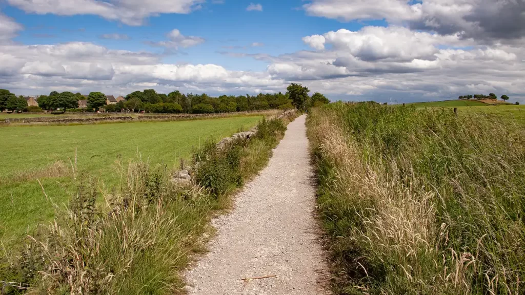
Follow Lodge Moor Road until the road bears left to head uphill. At this point walk straight ahead onto the Public Footpath, with a playground on your right. Follow the footpath for around 200 metres, looking out for a stile on your left with a plank footbridge over the Redmires conduit. Turn left and cross this stile and walk straight up the field towards a line of trees. Climb the ladder stile over the stone wall and head right along the road (Brown Hills Lane).
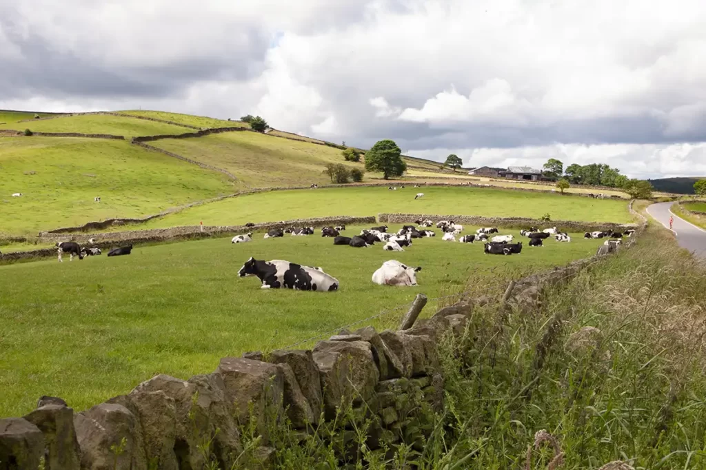
Walk along the road to a junction beside Peat Farm on your left at the foot of Roper Hill then, just after the junction cross a ladder stile on your left.
This stile is technically the point at which this walk enters the Peak District.
Follow the Public Footpath sign uphill and over 2 more ladder stiles.
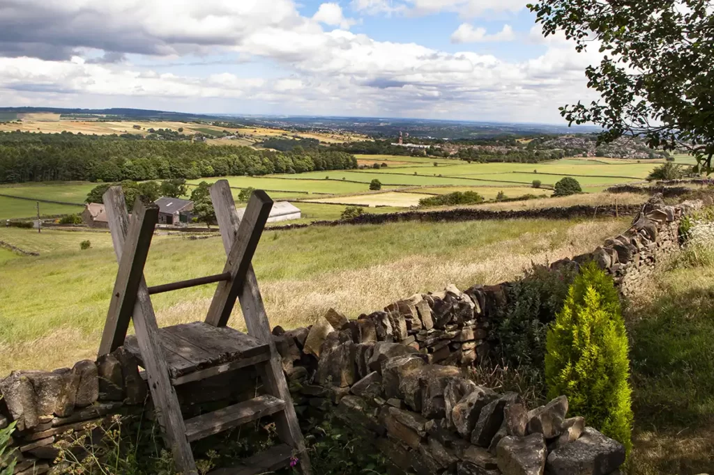
After the final and steepest of the ladder stiles is a shaded bench engraved “Winnie’s Bench” in a small stone-walled wild garden with views back over the Rivelin Valley below and over to Stannington on the outskirts of Sheffield and the Bradfield Moors opposite.
2. Brown Hills Lane to Redmires Reservoir
After passing this delightful little spot at the top of the hill, as you emerge onto the road, immediately turn right and head along the Public Footpath which heads West along a wide track. Stay on this easy-to-follow track which begins to bear half-right and downhill as the first of the Redmires Reservoirs comes into view. Follow this downhill, cross a stile and head right along the path by a stone wall.
3. Walk Around Redmires Reservoir
On reaching a gate on your left, pass through this (signed “Lower Redmires”) to head in a clockwise direction around the reservoirs following a clear path which follows the side of the reservoir before it climbs slightly up from the bank to eventually reach the dam wall and the middle of the three reservoirs.
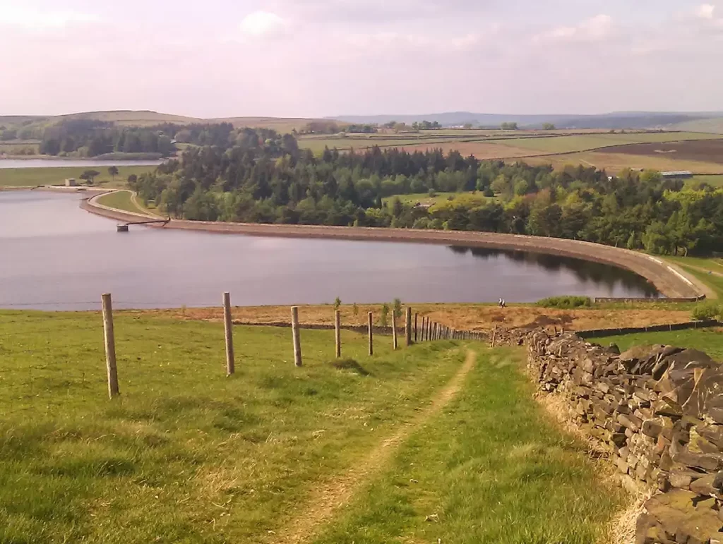
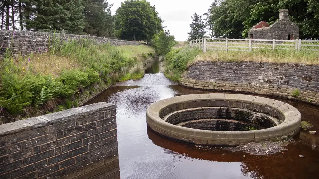
Stay on this path and, about halfway along the second reservoir follow the marker post left onto a paved section of the path which winds its way over otherwise marshy ground, to reach the dam wall of the third and largest of the reservoirs. Keep following the waymarkers on the main path which crosses a small concrete bridge and later emerges at the end of a tarmacked road. Head right to follow the road which runs alongside the bank of the reservoir, turning right and passing a car park. Continue along the road until you reach the dam wall. Upon reaching the dam head left on the Public Footpath along the conduit, noting the large bellmouth spillway which drains into the reservoir when the water level in the conduit rises, and passing beside a derelict stone hut.
4. Redmires Conduit to Ash Cabin Flat
Follow the path which runs beside the conduit and pass through a set of two gates. Continue along until you pass through another gate. Our route turns right onto access land immediately after the gate, however ahead of you on the main path you will see a small stone surveying tower. You may wish to investigate this before heading east onto the access land beside the gate.
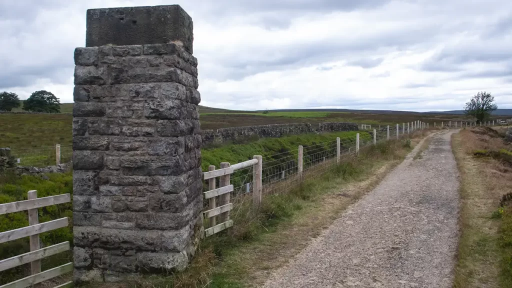
After turning right off the gravel path, follow the path on the moorland which follows the line of a stone wall to your right which is, apart from a couple of short broken sections, mostly complete. The path slopes downhill and, when the wall turns 90 degrees right, turn right along a narrower path, following the direction of the wall.
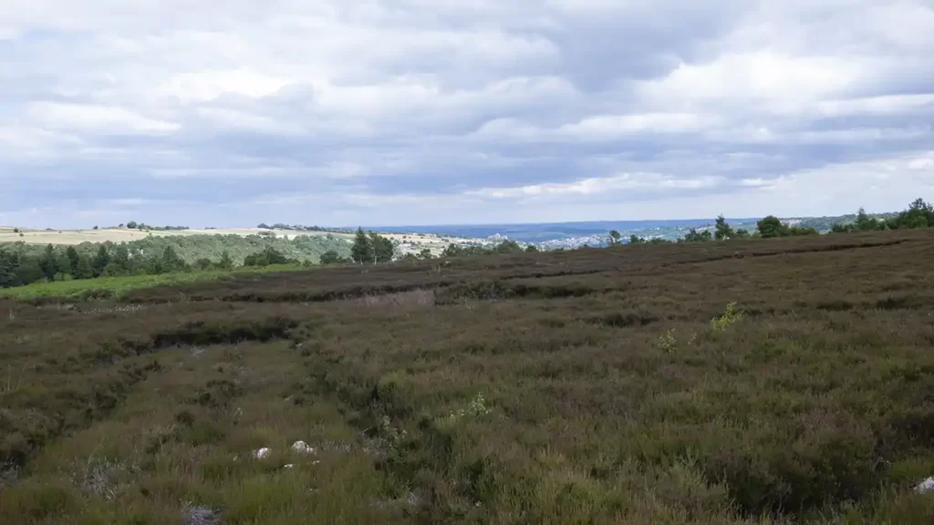
The path passes through a short wooded section. Upon emerging from this, the Ash Cabin Flat stone circle, a neolithic or early bronze age stone circle, lies to your right at grid reference SK269863. In the summer months (and for much of the year) the stone circle is difficult to distinguish as it is covered in heather and, being the smallest known stone circle in the Peak District was only discovered in 1981 and only two of the stones remain standing.
5. Ash Cabin Flat to Wyming Brook
When you have explored (taking care doing so, especially in nesting season) return to the path and continue south. The path may head through tall bracken but it remains fairly clear, it then rejoins the stone wall just before a wall corner. At the wall corner keep straight ahead, heading roughly south, passing through a hand gate and continuing in this direction until the path drops to the edge of the car park at the top of Wyming Brook. Look a little to your left and see a path heading down steps (signposted “Fox Hagg”) and follow this down to stepping stones over Wyming Brook. Cross the stepping stones then climb slightly right up a set of steps. Pass a disused stile on your left at the top of the steps then pass through a squeeze gate to join the road just before a junction.

6. Soughey Lane to Lodge Moor
At the junction turn right (south) along Soughey Lane. Take the first Public Footpath on your left, opposite Wyming Brook Farm, along a clear path. Keep following this path past Redmires Wood on your left. Eventually reach the junction with the playground that you passed close to the beginning of the walk.
When reaching Lodge Moor Road, instead of retracing your steps along the road, take the Public Footpath slightly opposite. The path continues along the route of Redmires Conduit, between fields until reaching Blackbrook Road. Turn left along Blackbrook Road to return to the start.