Slitherstone Hill Walk Overview
A scenic Slitherstone Hill walk from the border of the white and dark peak areas, passing old lead mines, dropping down to the edge of Peak Forest, returning beside Eldon Hill with views of Mam Tor, Lose Hill, and Stanage Edge on the horizon. A straightforward walk but with two high stiles to negotiate.
Distance: 5.83 Miles (9.4km)
Total Ascent: 749ft / 228m
Time: 2hr 50mins
The time is loosely based on Naismith’s Rule and will vary depending on the walker.
Directions
Windy Knoll to Old Moor, beside Slitherstone Hill
Beginning the Slitherstone Hill Walk from the picnic site car park on the A6, walk east (downhill) to a public footpath marker that points left up Mam Tor, and a track and gate on the right-hand side of the road. Turn right through the gate onto the path over the aptly named Windy Knoll.
Follow the clear path over WIndy Knoll to a gate at the far end. Go through the gate onto the road, then take the gate ahead-right onto the drive signed “Rowter Farm Campsite”.
Walk along the tarmac drive, passing Rowter Farm on your left and the hilltop of Slitherstone Hill to your right. Eventually arrive at a gate with a ladder stile to its left. Pass through the gate, keeping straight ahead and continuing down the track. After about 1/3 of a mile, reach a track junction.
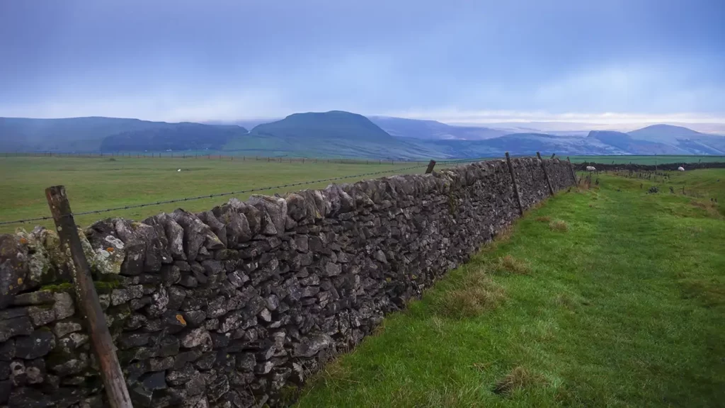
Turn left on the track and walk to the next junction, through a gate. Turn right through another gate, signposted “Limestone Way” and then bear right, walking adjacent to the stone wall to your right, across Old Moor. Follow the path beside the wall down the field. At the bottom end of the field, the path passes to the left of two mounds as a broken stone wall curves in from the left and reaches a junction at the far corner. Turn right through a gate and walk up the bridleway with a stone wall to your right and a fence to your left.
Old Moor to Old Dam
Walking along the Limestone Way route, keep straight ahead through another gate, the bridlepath now becoming a vehicle track.
Pass beside the mounds of the old Clear-the-Way Mine on your right, and behind them, the round hilltop of Ox Low.

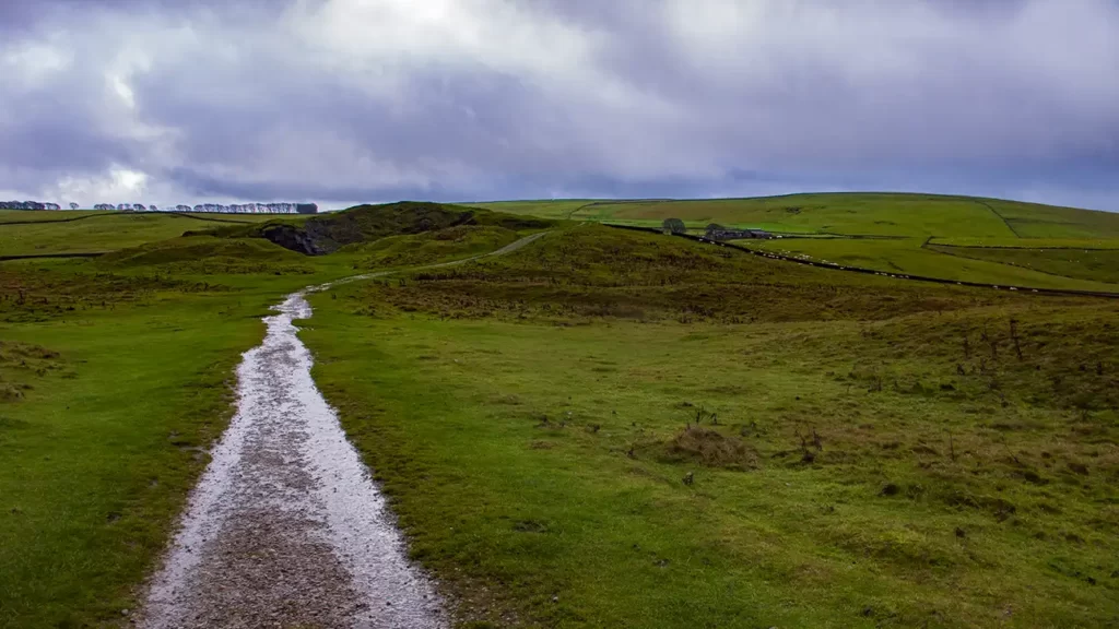
After passing Ox Low the bridleway track begins to descend to reach a gate. Go through the gate; the path curves gradually down to the right passing mounds and entering a wooded area beside Oxlow Rake.

Stay on the track, passing by farm buildings on your right, down to a gate. Go through the gate and cross the drive to a stile ahead-right, just beside the farmhouse driveway gates. Climb the stile and walk along the right-hand side of the field; over another stile into the next field and walk diagonally left towards a stile about halfway along the opposite wall.
After climbing the stile, bear slightly right, aiming just to the left of a farmhouse. Climb another stile in the far corner of the field and cross two more small fields separated by a stone wall and stile, then emerge onto a track through a hand gate (Old Dam Lane)
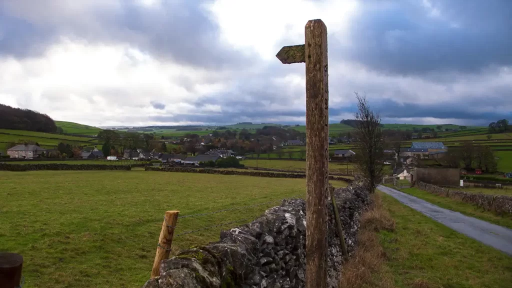
Turn right up the track for approximately 50 metres, then turn left over a stile at a footpath signpost. Head straight across the field to a stone stile with a very high first step, Keep straight ahead, passing another stile by a broken stone wall, then over another stile with wooden fence posts onto Eldon Lane. Turn right to walk up the road.
If you are traveling by Public Transport, your Slitherstone Hill Walk begins here, as you climb Eldon Lane. To return to the village of Old Dam and the bus stop turn right and walk down Eldon Lane

Old Dam to Slitherstone Hill
Walk up the road, passing Sweetknoll Farm. After Sweetknoll Farm the road becomes a farm track that passes through Eldon Lane Farm and then climbs more steeply up to a gate.
Head through the gate and continue ascending, gradually getting closer to the wall to your right as you climb. As the wall curves to the right, follow the line of the wall, still ascending until you reach a stile at a wall corner with the trees of Watt’s Plantation ahead.
Do not cross the stile, instead bear left, continuing to ascend with the wall to your right. As the path passes the plantation, it begins to bear slightly left as it skirts the tumulus and the eastern side of Eldon Hill to your left, then drops back down to the wall, to a gate ahead.
Pass through the gate and continue alongside the wall. At the far end of the field continue through another gate onto a track. Turn right along the track and continue to a path junction just beyond a gate.
Slitherstone Hill Walk back to Windy Knoll
At the path junction, turn left over a stile and walk alongside the stone wall on your left. As you ascend Slitherstone Hill, Mam Tor becomes visible ahead. Cross a stile and continue following the line of the wall.
As you crest Slitherstone Hill, some of the best scenery of the walk comes into view. Take in the wide panoramic view. Rushup Hill and Mam Tor sit ahead-left, with Hollins Cross and Lose Hill directly ahead of you. Farther to your right you can see the “witches nose” of Win Hill Pike, then Bamford Edge and Stanage Edge escarpments.

Cross another stile at the field corner and continue ahead, the path now descending and bearing roughly toward the large mass of Mam Tor.
The path joins the Rowter Farm drive just before the gate. Head through the gate, cross the road and through the gate ahead and just to your right, retracing your steps over Windy Knoll back to the A6 and the start.