Round Wolfscote Dale Walk from Hartington Overview
Beginning at the scenic village of Hartington, this white peak district walking route heads south to join the River Dove and Wolfscote Dale; heading down the riverside passing a small cave, before crossing into Staffordshire, climbing steeply to Alstonefield. From Alstonefield the walk heads back to Hartington, skirting Narrowdale Hill before following Beresford Dale back into Derbyshire and returning to the start.
Distance: 8.63 Miles (13.9km)
Total Ascent: 981ft / 299m
Time: 4hr 0mins
Time is loosely based on Naismith’s Rule and will vary depending on the walker.
Directions
Hartington to Wolfscote Dale
From the car park, had north along Mill Lane, passing the Hartington Farm Shop & Cafe on your right Follow the road around to the right past the village square, passing the post office on your right, then turn right to walk up Hall Bank.
Follow the road up Hall bank which climbs and swings round to the left. Continue past Hartington Hall Youth Hostel then shortly after, just before the National Speed Limit road sign, turn right up the lane.
Follow the lane, a gravel track, until the track turns right. Here, keep straight ahead through a gate to follow the path between two low stone walls, then at a finger post bear half-right down the field, through a gap in the stone wall, then over a stone stile onto a narrow road.
Turn right along the road (Reynards Lane), heading almost back on yourself. Walk along the road, passing under power lines then at a junction with a track, turn left along the track, signed Wolfscote Dale.

Continue along this track between two stone barns, staying on the track as it eventually turns left to join a narrow lane. Turn right along the lane and follow the road, descending until you reach a walled track on your right. Turn right down the track and keep following it as it turns left and narrows, dropping down to eventually meet the River Dove at the start of Wolfscote Dale.
From Wolfscote Dale Walk to Coldeaton Bridge
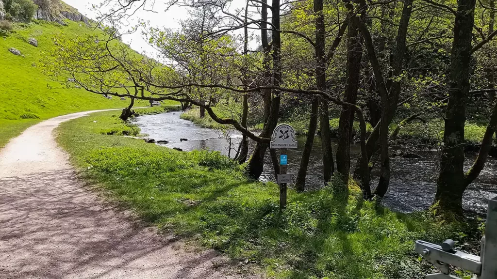
Turn left through the gate into Wolfscote Dale walk with the river Dove to your right. This section of the walk needs no detailed description, the path follows alongside the river with the steep limestone side of the dale rising to your left.
Eventually, after passing by small weirs, reach a path junction and a finger post with Biggin Dale heading off to your left Keep straight ahead, still following beside the river, through the gate.
Immediately after the gate, if you look up to your left you can see a cave in the limestone above, which is a fairly easy climb with a narrow path heading up to it if you wish to see it more closely

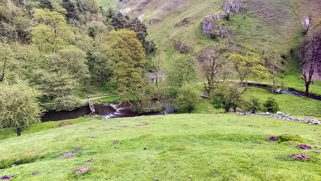
After passing the cave, continue alongside the Rover Dove. The path is now shaded by trees as the landscape changes from limestone sides to woodland. Pass one footbridge shortly after the cave and continue along with the river on your right, until you reach Coldeaton Bridge on your right.
Cross Coldeaton Bridge and prepare for a short but steep climb to start the next section, from Wolfscote Dale walk to the village of Alstonefield
Gipsy Bank to AlstoneField
After crossing the footbridge, follow the path which zig-zags up the steep hillside known as Gipsy Bank – don’t feel ashamed if you need to stop for a breather part way up, the ascent is fairly short but very steep. Stopping is recommended whether part way up or at the top, to look back down over Wolfscote Dale and over to the opposite side.
At the top of the climb pass through a gate and continue along a track which continues to climb but at a much more gradual ascent. Follow this track which eventually turns sharp right then left, then keeps heading straight until you eventually pass a Youth Hostel on your right, then reach a road (Lode Lane).
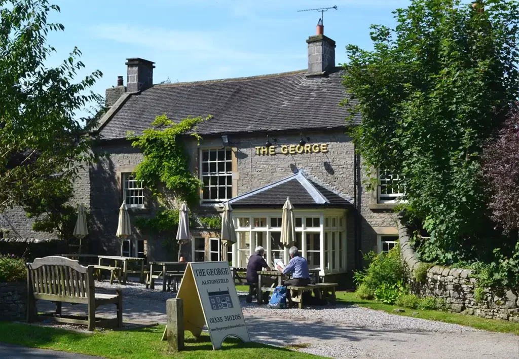
Turn right along Lode Lane and follow this road into Alstonefield
Alstonefield to Beresford Dale
Walking down Lode Lane into Alstonefield, stay on the road to pass the Wesleyan house on the right, then turns right to reach the Alstonefield Car Park and Public Toilets.
Pass the car park and continue along the road, ignoring a gap in the stone wall on your right. Pass houses on your right and a road on your left (signposted for Wetton, Ilam and Dovedale) then immediately take the lane half-right, then at the lane junction with a tree in the centre, bear right.
Follow the lane as the tarmac surface ends and becomes a gravel track, which soon bears half left, then, as the track bears right again, turn left through a hand gate to follow the footpath along the left of a small field.
Continue along in this direction (roughly north west) through several fields on the obvious path, to reach a stile through a stone wall and a finger post. Do not continue straight ahead, turn left and walk alongside the wall to reach the road. Instead of passing through the gate to the road, turn sharply right to follow the footpath diagonally across the field towards the cap in the stone wall with the tall stone gate post on the right.
Go through the gap in the wall and continue in the same direction to the far corner of the next field. Continue up to a hand gate through the nest stone wall. Go through the gate and keep straight ahead, crossing the track and through another hand gate into the next narrow field. The path continues in this direction into the next field and across to the far corner.
Continue through into the next field, the path now follows beside the stone wall to your left. Follow this path which begins to turn slightly left towards Narrowdale Hill, before leaving the wall and bearing slightly right, descending gently to a stone wall.
At the wall, whilst you can take a shorter route along the footpath through the gate, this leads to a steep scramble at the end of the path requiring hands to aid descent – for the easier route continue along with the wall to your right, to reach Narrowdale farm. Turn right down the track at Narrowdale Farm to descend steadily to a path junction.
Whichever route you chose, here go through the gate to head along the level track headng north towards Beresford Dale. This track offers no navigational challenges, simply follow this until it eventually emerges at Beresford Lane. Turn right along Beresford Lane towards the river then turn left before the footbridge onto the path left of the river.
Beresford Dale Back to Hartington
Follow the path which runs left of the River Dove initially – the river being the Staffordshire border. After a short distance, arrive at a footbridge which crosses over to the right bank, and back into Derbyshire.
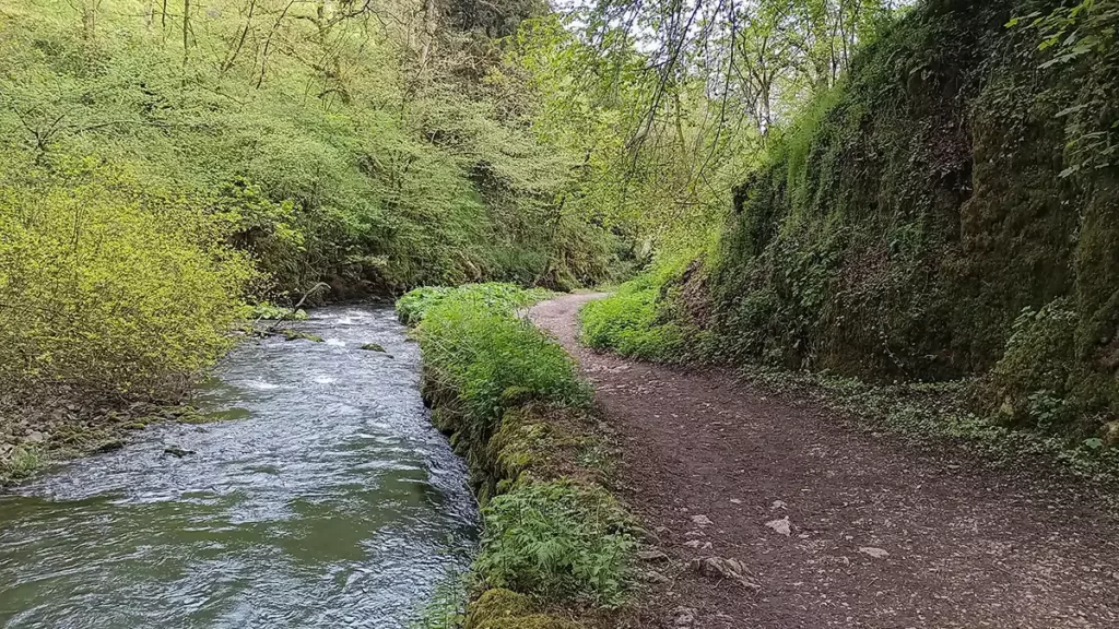
Follow the path which winds alongside the river, under tree canopy cover, for a while before gradually heading away from the river and emerging into fields. The path ascends beside Pennilow to the right with earthworks from a possible Romano-British settlement from around 43-409AD)

Continue following this path which climbs steadily, soon becoming a clearly worn and easy to follow path. Reach a track through a stile. Cross the track and head through another stile. Still on the clearly worn path, continue with the road into Hartington below across fields to your left. Pass behind farm buildings and follow the path as it swings left to reach a gate. Head through the gate and descend the steps between the farm shop and the public toilets.

The Hartington car park is to your left, or, if you started from the village square, turn right into the village.