A shorter walk but with over 1000 feet of ascent, this route takes one of the easier routes up Win Hill to take in views over Hope Valley, Bamford and Ladybower Reservoir before dropping down Thornhill Carrs to the Yorkshire Bridge over the River Derwent. Heading up the New Barn path at the beginning of the route, the ascent is a much easier Win Hill walk than the hardcore route straight up Parkin Clough, taking a route across the slope to ease the gradient through the woodlands
Win Hill Walk Overview
Distance: 4 Miles (6.5km)
Total Ascent: 321m /1056ft
Time: 2 hr 20min
Map: Ordnance Survey OL1 (The Peak District – Dark Peak Area)
Get this route on the OS maps website & app
The time is loosely based on Naismith’s Rule and will vary depending on the walker.
Getting There
By Car:
Roadside Parking just north of the Yorkshire Bridge Inn (Postcode S33 0AZ) on the A6013 Ashopton Road close to Bamford. If there is no on-road parking available you can park in the Heatherdene pay & display car park a little further north (S33 0AQ)
Public Transport:
Bus Service 258 Sheffield to Bakewell stops at the Heatherdene car park just a little north of the walk starting point
Bamford Road to New Barn Path
From the start near the Yorkshire Bridge Inn, head north to the large iron gates of the dam on your left (or if parked at Heatherdene, head south to the gates which will be on your right).
Head through the gates and cross the gravelled permissive footpath over the dam.
At the far side of the dam, turn right and walk along the unclassified road which swings right then left, passing one of the bellmouth spillways (or “plugholes”) on your right, which drains into the river Derwent when the reservoir is full. Look out for a path heading half-left diagonally uphill signposted “New Barn”
Follow this rough path up to a path junction at a wooden fence
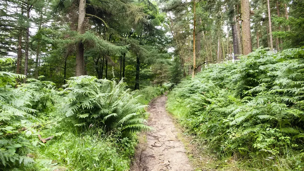
Walk Up Through Win Hill Plantation
At the path junction turn left, following the green arrow, signposted just after the fence ‘Thornhill and Parkin Clough’.
This track can become muddy as you pass through a gate. Keep to the right of the track to avoid the worst of the mud. Continue up the track, passing a short section of wooden fence on your left, and climbing steadily through the woods.
When the track levels out briefly and forks, a narrower path dipping down straight ahead, take the wider path on your right, following the green waymarker arrow and climb through the trees to reach a metal gate. Pass through the gate, turn right then almost immediately bear left before the end of a broken stone wall, leaving the green arrow waymarkers and heading uphill to climb out of the plantation.
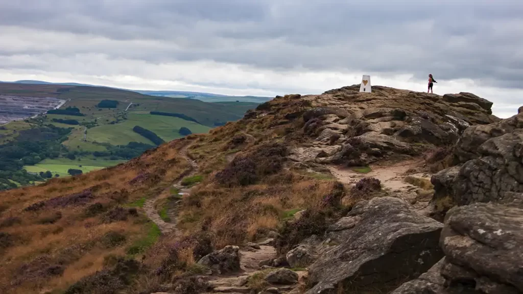
Win Hill Pike
As you climb out of the plantation the nature of the path changes to stone steps heading uphill. Stay on the steps which climb away from the plantation to reach two concrete steps as you pass through a stone wall, then continue climbing the steps straight ahead of you to summit Win Hill Pike.
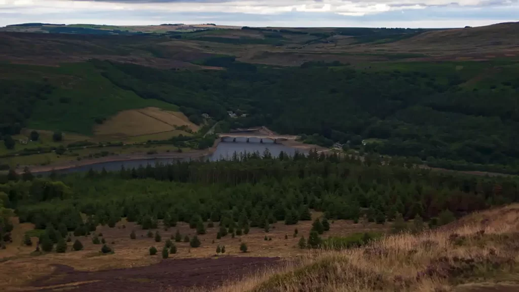
On a clear day Win Hill Pike offers views all around; to your right and behind you views over Ladybower and the Ashopton Viaduct; ahead left the Hope Valley cement works which although a man made blot on a beautiful natural landscape, has played a large part in shaping the Hope Valley villages and population; directly ahead of you the lumpy Mam Tor (also known as The Shivering Mountain) and to its right the point of Lose Hill.
Descent to Thornhill Carrs
Walk to the trig point then drop down rocky steps to your left to a clear path, then head right (west) on the path which drops to a path junction. Turn sharp left, almost back on yourself, to head roughly east below Win Hill Pike which is now to your left.
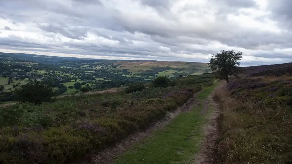
Follow this path through a gate ahead, descending gently with a stone wall to your right and the gritstone of Bamford Edge ahead on the opposite side of the valley. As you reach the end of the wall on your right and with a path joining from your left, ignore the temptation of the wide clear path which heads half-right. Instead, keep straight ahead on the narrower path which descends now with a stone wall and a small wood on your left. Head past the wood, passing a stone wall on your right, continuing downhill and eventually stepping over an old, broken stone wall to a clear path running left to right.
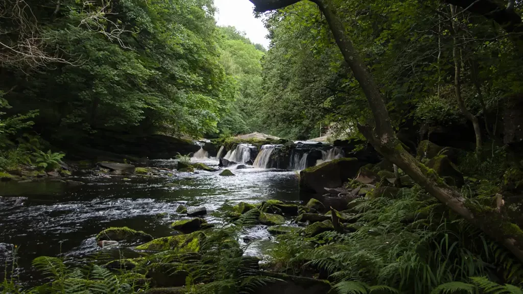
Thornhill Carrs to Yorkshire Bridge
Turn right (south) along this path. pass two small trees on your right and reach a finger post just after a stone trough. Bear left downhill on the main path to reach another finger post by a stone wall. Turn left beside the wall and drop to a wooden gate. Bear right through the gate and follow this path downhill.
Pass through a twin gate and continue downhill until you reach a path junction with stepping stones heading half-right across boggy ground. Before the stepping stones, bear left down the steps and turn left again.
Follow this path which heads north-north-east and is easy to follow heading steadily downhill until eventually reaching a wide track. Go left onto the track then immediately half right to continue NNE down the narrower path which drops to the road at Yorkshire Bridge.
Yorkshire Bridge & Return to the Start
Turn left onto the road then right over Yorkshire Bridge which crosses the River Derwent. Just after crossing the bridge turn left onto a path between wooden gateposts which gently climbs to another path at a gravelled section. Turn left along this path and walk to a gate. Just before the gate, bear right uphill onto a path which climbs through trees then bears slightly right and steepens a little as you come to the side of the dam that you crossed at the beginning of the walk. Follow the path back up to the gates at the dam entrance and return to the starting point.