A demanding 10 mile walk taking in the high viewpoints of Ramshaw Rocks, over Hen Cloud & The Roaches, descending to the chasm of Lud’s Church, and returning below Gradbach Hill.
Even after hot dry weather, Lud’s Church can be very muddy, with stepping boards, stones and logs used to cross the mud. Together with the uneven nature of other paths on this route, this makes walking boots an absolute essential. A trekking pole is not essential but is incredibly useful when crossing the mud in Lud’s Church.
Roaches & Lud’s Church Walk Overview
Distance: 9.97 Miles (16km)
Total Ascent: 2199ft / 670m
Time: 2 hr 20min
Map: Ordnance Survey OL24 (The Peak District – White Peak Area)
Get this route on the OS maps website & app
The time is loosely based on Naismith’s Rule and will vary depending on the walker.
Getting There
By Car:
Roadside Lay-by opposite Stake Gutter Farm, 1/2km south of The Winking Man public house on the A53 Buxton to Leek road. The lay-by is on the northbound side. Winking Man postcode ST13 8UH
Public Transport:
Bus Service 108 from Leek stops at The Winking Man pub, walk south from the pub to the lay-by to the start of the walk.
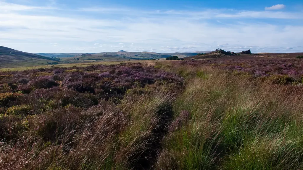
Ramshaw Rocks to Ferny Knowl
From the lay-by, opposite Stake Gutter farm, walk south then turn right onto the Public Footpath signed ‘Churnet Way’. Climb the makeshift stile over the fence and head diagonally across fields towards Ramshaw Rocks.
Cross a stile and turn left following the Public Footpath beside the wall behind the rocks. At a path fork, keep straight ahead through a gate and follow the path to Ramshaw Rocks through another gate at the corner of the dry stone wall.
The path passes behind rocks at first, before summiting part-way along the outcrop. Continue on the main path along Ramshaw Rocks, keeping straight ahead as you pass behind the last large outcrop and then dropping down to a minor road on your right.
Ferny Knowl to Hen Cloud via Roaches Hall
Descend the path from Ferny Knowl, ford a small stream, climb over a stile and pass right of remains of an old farm building. Ignore a hand gate on your left, instead swing right on a path heading north-west and through a hand gate onto a clear track, bearing right along the track.
Follow this clear farm track up to the entrance of Hall Farm. Just before the track enters the farm turn left on a path marked “Concession path to The Roaches”. Cross a stile and climb the hillside to reach another footpath which runs left to right.
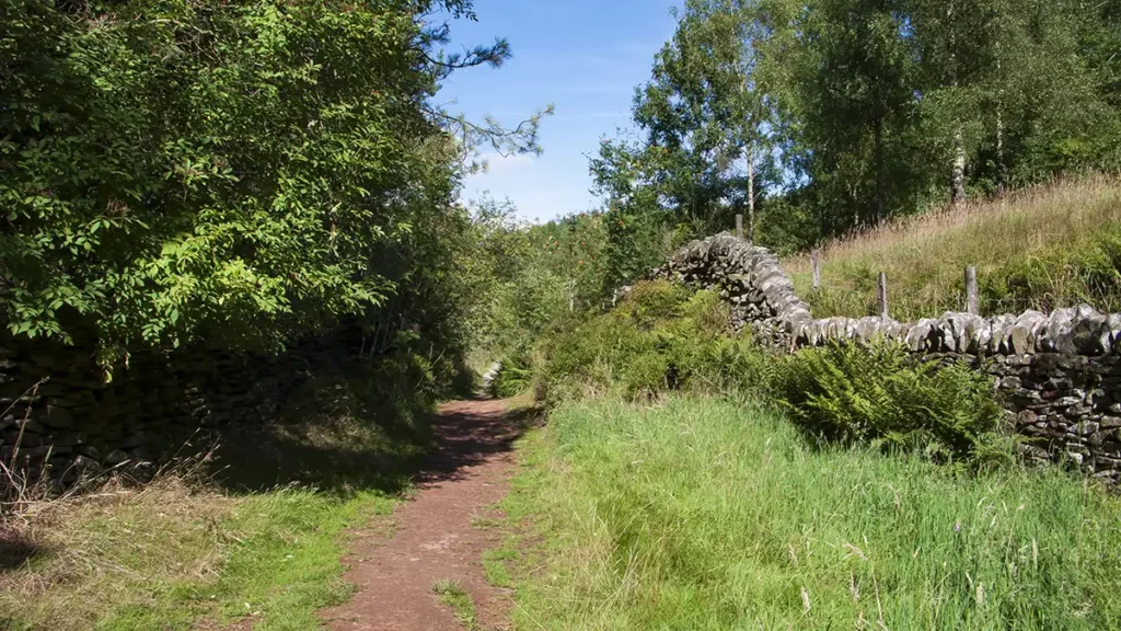
Turn left on the narrow path that contours around the hillside and go through a gap in a stone wall into a wood. Follow the prominent path through the wood and through bracken to join a wider path.
Continue heading downhill past a small group of large boulders and through a gate on your left to reach Roaches Hall

Head right, passing Roaches Hall and head down the drive and over a cattle grid. Shortly after the cattle grid look out for a path heading right and uphill between two stones. Take this path heading partly back on yourself as you climb, passing the cattle grid once again below to your right; keep bearing left keeping fairly close to your rocks on your left as you pass around them.
As you notice a clearer path heading downhill, instead continue around the rocks on your left, maintaining height; soon after this the path up to Hen Cloud out of the woods becomes clear ahead.

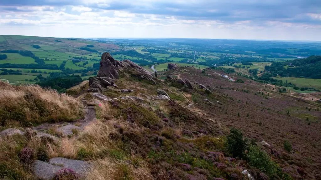
Leaving the trees, climb the path with a rock outcrop jutting out towards you ahead then bear left along a path that heads towards a gap between two large boulders. Walk towards the boulders then turn right just before them, ascending the path to the top of Hen Cloud, with wide views over Tittesworth Reservoir and the surrounding countryside
Hen Cloud & over The Roaches
Head along the top of Hen Cloud heading north by north west towards The Roaches which are clearly visible ahead as you drop down the obvious path from Hen Cloud.
Pass through two hand gates and continue straight ahead up the path heading up to and passing through a gap in a dry stone wall ahead.
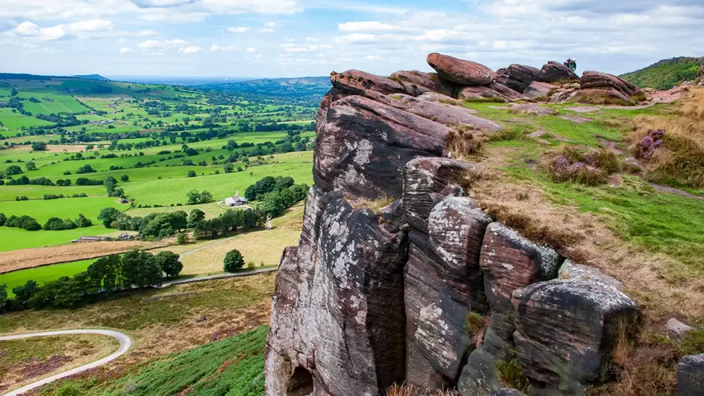
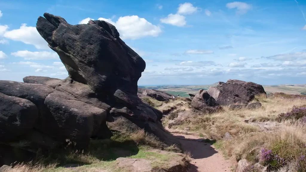
Walk through this climber’s playground with the first section of the gritstone escarpment above you to your right.

On reaching a path junction turn right and head uphill climbing to the top of The Roaches on a steep but easily walkable path. Turn left at the top to walk along The Roaches. Pass Doxey Pool, the site of a mermaid legend, on your right and follow the guidance to stay on the rockier footpath to prevent erosion of the peat moorland on this popular and sometimes busy path.
Continue along The Roaches past the trig point and stay on the main path as it then descends down to the road at Roach End. On a summer day, there is often an ice cream vendor to be found at the roadside at Roach End.
Roach End to Lud’s Church
On reaching the road, turn right heading down the metalled track signed “Public Bridleway” then, shortly after as the track begins to bear right, turn left up steps and through a gap in a wall onto Public Footpath heading downhill beside a dry stone wall on your right.
The path bears left as it drops into Back Forest and then, at a path junction and signpost, bear left signposted “Lud’s Church / Swythamley”
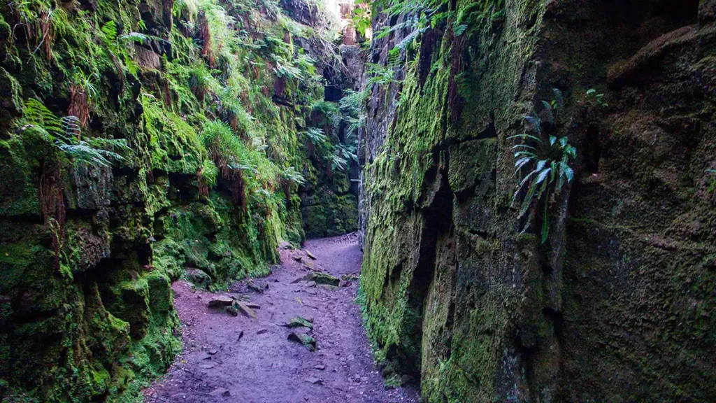
Continue along the wooded path until another path junction and signpost. Here, turn left, signed “Lud’s Church and Ridge”. Very soon afterwards at the next path junction, turn right, following the path over duck boards, again following the sign for “Lud’s Church” until you arrive at the chasm of Lud’s Church. This narrow channel between the gritstone is reputed to have been used as a secret place of worship by the Lollards, and also suggested as the site of The Green Chapel as referred to in the Arthurian poem Sir Gawain and the Green Knight.
Lud’s Church & Below Gradbach Hill
On reaching the path junction turn right, signposted “Gradbach”. Take the rightmost path which descends through Back Wood. At the next junction keep straight ahead, signposted “The Roaches” and reach another junction at a stepping stone river crossing.
Turn left and cross the stepping stones then bear half-left to walk uphill on the Public Bridleway.
The bridleway turns to the right as a path meets from the left. Bear right continuing uphill heading approximately north-east towards Gradbach
The bridleway narrows and keeps climbing in the direction of Gradbach. Pass a private drive on the right then, shortly afterwards as the bridleway track levels out, turn right over a stile beside a gate and then pass left of a farmhouse.
Walk through the farmyard, exiting through a gate at the far side and continue to climb the farm track.
Make your way through two fields with a wall on your left then. as the track ends, pass through a gate on your left and continue in the same south-easterly direction now with the wall to your right, and the edge of Gradbach Hill over to your left.
Pass through a field then part way through the second field the path bears slightly left, away from the wall towards a tree. As you reach the tree bear left up to and through a hand gate and follow the path as it ascends with a dry stone wall to your right.
Pass a gate on your right, keeping straight ahead uphill alongside the fence to your right.
At the top of the ascent, pass a footpath marker post, ignore a gate on your right and follow the path as it bends slightly to the left, keeping the fence on your right.
Pass through a gate straight ahead and descend to the corner of a minor road, with the road ahead and left and a farm track to your right.
Blackbank and Hazel Barrow
Turn right on the Public Footpath over a stile just after the farm track and head south, ignoring temptations of clearer-looking paths that head off to your left towards the road; the southward path soon becomes more obvious as you progress.
Pass a footpath marker post to the right of some small stone ruins and continue straight ahead through a stone squeeze stile, after which step over the old dry stone wall on your right and walk to the right of the wall, soon bearing right towards a stile.
Cross the stile and walk around the left of the field. At the bottom corner of the field, turn left. At a footpath sign at the far right-hand corner of the next field with farm buildings to your right, keep straight ahead crossing a farm track beside Goldsitch House, then follow the footpath arrows half left up to a gate and signpost.
Turn right, signposted ‘Ramshaw Rocks via Hazel Barrow’, bear left over a stone bridge and then right beside a gate onto Public Footpath, then left over a stile.
Keep to the waymarked path, crossing a stile and continuing directly to the left of a fence. Pass through two gates, watching your step on the section between them on the rocky uneven ground; after the second gate bear left heading uphill.
Cross a wooden bridge and stile to reach a road. Turn right, up the road to the road junction at Hazel Barrow.
Last Leg: Hazel Barrow to Stake Gutter
Pass the road on your right opposite Corner Cottage, then head right through a hand gate heading south by southeast and continue in this direction, roughly towards Ramshaw Rocks that you can see ahead.
The path climbs up the moorland to a stile over a fence. Cross the stile then walk diagonally left down the field, signposted “Churnet Way” and continue in this direction retracing your steps from the start, back to the road.
Turn left up the road back to the Stake Gutter layby and the start.