Sometimes a walk doesn’t go all to plan
Mapping out a walk usually goes fairly well. More often that not, a walk is planned, walked, blogged and photographed in a single “take”. Other times it may need a revisit to either the entire walk or a section, if a more suitable route is evident when on the ground, than was when planning the route with a map.
Sometimes the weather plays a part too.
A Positive Start on a Clear Winter’s Day
I headed out on a cold but dry Sunday in early January from Bakewell – taking the chance in off-season to park in the honeypot town with fewer cars and less visitors. The Coombs Road car park close to the bridge and livestock market was still fairly busy, although finding a parking space wasn’t an issue.
I’m not a regular visitor to Bakewell by car – it all gets too busy for my tastes in the summer – but it seemed to me like the ANPR on the car park was a new addition, given the car park attendant hovering by the payment machines, eager to explain the system. On the face of it, it seems a reasonable system – the ANPR reads your car registration on the way in – you need do nothing upon entry, just park up and head off walking. On return, put your registration into the machine and you will be charged for the time you have parked, rather than guessing how long you need in advance. Arbitrary automatic systems can have pitfalls however, so it remains to be seen whether problems occur. But this isn’t a blog about car parking….
A Bit of Mud – Nothing Too Bad
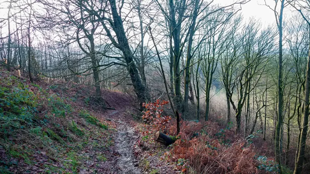
Heading out along Coombs Lane and then up to Calton Pastures was a fairly regular experience. The climb up through Manners Wood was a slippery and steep affair and I was glad to have brought along a singular walking pole to help gain traction and support when climbing up the slippery slope beside the stream.
Once the climb was done with, emerging onto Calton Pastures the going was much easier, although the ground here can still get waterlogged. My Decathlon Waterproof Boots did a sterling job of keeping my feet dry as I squelched along the near-top of the pasture.
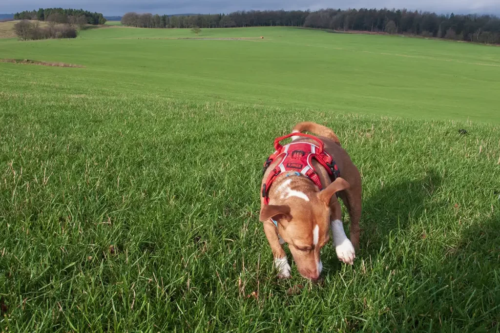
Bram, the little terrier who I walk on Sundays positively adored the vast space of Calton Pastures all to himself. Luckily for him there were no grazing sheep so he could have a little bit of off-lead time whilst being watched of course. Note: Calton Pastures is sheep-grazing land so it will not always be so deserted in the summer months.
Things got slippery again although nothing too difficult, on the descent back through Manners Wood towards Bowling Green Farm. The route’s turns and waymarkers were being duly noted as I progressed, confident of wrapping up another walk entry for the White Peak Walks page. That is, until reaching the River Wye at the bottom of Haddon Park.
And it all Starts to go Wrong!
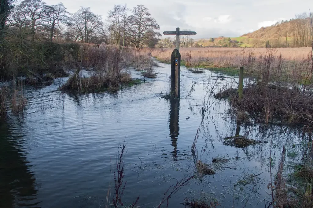
“Before the lane crosses over the river Wye” I noted, “Turn right along a path marked as both a Public Footpath and a Public Bridleway”. “At a fork in the path, take the left…” Ah!
The left fork, where the Footpath and Bridleway diverge, headed down steps and straight into what was effectively the river, a footpath marker post sticking forlornly out of the water. Drat…at this point I wanted to note down the footpath route back to Bakewell for the route guide. “Never mind, this is good” I told myself “This is perfect. I can write the alternative route in case of the footpath flooding, by the bridleway”. Off I went, following the bridleway until…..it dropped back don to the Wye and more flooding.

A footbridge over the a ditch to the footpath was impassable so the only option was straight on a shin deep wade. No waterproof boots stay waterproof when fully submerged and the little terrier had to swim across patches of the flooding, it was too deep for him to paddle.
“Ah well, the worst of it done” I thought, and carried along the brideleway up to a very full and not all that narrow ditch. Finding the narrowest spot, doing a quick trouser adjustment, a leap over the ditch was just about at my “standing start long jump” limit. Phew – what’s next? Ah – ANOTHER ditch and this one a bit wider with more slope on the banks. Not jumpable at all.
Fortunately walking up the hedgerow to the top of the field led to a crossing point. Technically off the public right of way but, staying to the very edge of the field and only as far as necessary is reasonable given the circumstances.
By this point any attempt at noting down a route had been given up. This section will have to be repeated in the warmer, drier months before it can be fully described and added to the walks collection.
I was glad that this was only around 1 mile from the car park as my feet were starting to feel a chill in cold, wet boots.
I also got to wondering – 15 years ago, a hand held GPS seemed like an expensive, luxury extravagance and now we have the technology to hand in our phones. Perhaps it isn’t unthinkable that, with satellites already feeding occasional static images to the likes of Google Earth; one day we might be able to see a real-time (or very close to real-time) ariel view of rivers, stepping stones, fords etc. and see if they are swollen or flooded before setting out.
As for this walking route – it will be put on hold until drier times