This easy 3.5 mile woodlands walk begins from the neighbourhood of Bents Green drops down through Bluebell wood to walk along the Whiteley Woods section of the Porter valley. The walk leaves the Porter Brook at Forge Dam, heading up Priest Hill with views over Sheffield before returning to Bents Green.
Most paths are wide and easy-going except for a short rutted and sometimes muddy section with a climb within Bluebell Woods.
Bluebell & Whiteley Woods Walk Overview
Distance: 3.5 Miles (5.6km)
Total Ascent: 666ft / 203m
Time: 1hr 50m
Map: Ordnance Survey Explorer 278 (Sheffield & Barnsley)
Get this route on the OS maps website & app
The time is loosely based on Naismith’s Rule and will vary depending on the walker.
Getting There
By Car:
Park near the end of Bents Green Road (S11 7RA), off Ringinglow Road by the Bents Green Post Office
Public Transport:
A bus stop (Bents Road/Ringinglow Road, Stop Number 370021368) beside Bents Green Methodist Church is served by Stagecoach & First buses. The stop is directly opposite Bents Green Road. Alight here and walk down Bents Green Road.
Bluebell Woods to Whiteley Woods Trail
Walk down Bents Green Road to the very end of the cul-de-sac then follow the path which heads into the woods through a gap in the trees. Follow this path downhill until the path forks. At the fork in the path bear left down a wide path which snakes downhill to reach another path junction with 4 tree trunks in the centre. Turn left here and head back uphill climbing the steps. At the top of the steps, the path swings right and becomes a little rough over stones and tree roots before widening into a smoother woodland track, still ascending.
If you are following the route on the OS app it is worth noting that some of these woodland paths are unmarked at Premium Topo level – the official Public Footpaths and Bridleways head through overgrown terrain. Following the route on standard view is an easier way to navigate through this short section.
Upon reaching another fork bear right, downhill. The path becomes brick paved for a section beside a low wall on your left, then descends a little more steeply, reaching another junction. Here, you can see steps heading down to a bridge straight ahead/slightly left. Instead, bear right, following the path through the wood. Bear left at the next fork to descend gently down a clear and easy-to-follow path. Keep straight ahead at a signposted path crossroads, following the public bridleway. Bear right at the next fork and descend to the road.
At the road, turn left along the roadside footpath then immediately left again to almost double back on yourself. Cross a stone bridge on a wide, level path.
Whiteley Wood House to Forge Dam
Follow the clear path with Porter Brook running to your left and a goit running to the right of the path. The path reaches a weir before a twin-arched bridge with steps ascending beside the rightmost arch. Climb the steps to the road.

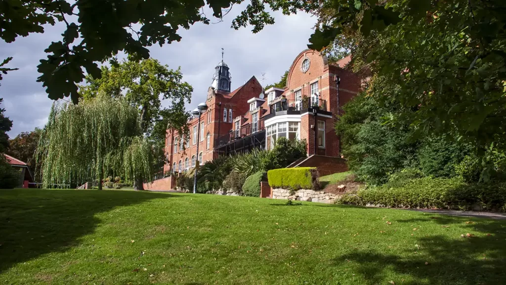
Cross the road heading briefly left over the bridge and follow the Porter Brook trail into the woods opposite. Turn right before a ford and climb 5 steps. After the steps, bear right to ascend the public footpath above the road on your right, emerging onto Woofinden Avenue. Turn left onto Woofinden Avenue and follow the drive through the gates towards Whiteley Woods House (a private road with public right of way).
Whiteley Woods House is today a residential building comprising private apartments. Previously it was named the George Woofinden Convalescent Home, then Whitely Woods Hospital before being sold and converted into dwellings.
As you approach the buildings, follow the clearly marked public footpath to the left which heads into woods and behind a service building for the apartment complex. Where the path forks, bear left downhill through an old metal gate, then left again down a narrow gravelled path.
At the end of the path turn left to pass through a metal squeeze gate, then immediately turn right; at first with a wall on your right, along a clear and wide public bridleway.
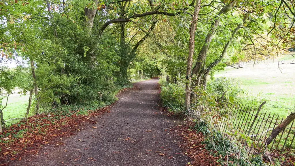
This bridleway, the Whiteley Woods Trail, runs right of Porter Brook. Stay on this path until you eventually reach a road near the entrance to Forge Dam.
If you wish to visit Forge Dam, a popular small park area with a playground, millpond, cafe and public toilets, the entrance is almost opposite. Like many sites along valleys of Sheffield, this peaceful recreational area was once a busy, noisy part of water-driven manufacturing, water wheels powering heavy drop-hammers for metal forging.
Forge Dam to Priest Hill
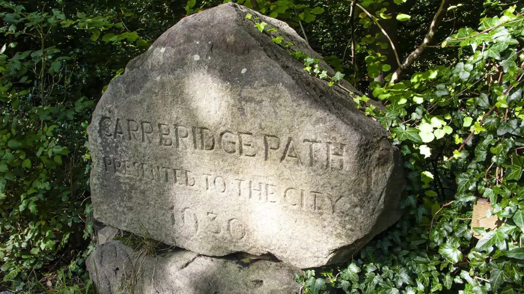
From the Whiteley Woods Trail, turn left along Ivy Cottage Lane then, as the road bears right into Forge Dam, walk straight ahead between 2 wooden fences (signposted “Peak District 2 Miles”) and head through a metal squeeze gate. At a fork beside a stone marking Carrbridge Path to the right, instead, bear left up the surfaced path.
At a gate on the left, signed “Public Footpath”, turn left through the gate and head up the path that climbs the field with a snore wall on your left. Keeping straight ahead through a gap between stone walls, bear half-left over the next field to a gate. Pass through the gate and walk along the right-hand edge of the field. At the far end of the field, head through a gate and along a path between a wall on your left and a fence on your right. Climb 5 steps to arrive at a road.
Head left along the road, keeping left at the junction to walk along Cottage Lane, passing Priest Hill Barn on your left. After the barn and an S-bend road sign, take the public footpath on the left over a stone stile, just before the road turns to the right.
Follow this footpath downhill, keeping to the right edge of the fields through two gates then over two stiles. After the second stile, bear half-right over a wooden plank bridge and follow the well-trodden path over another stile to reach an unsurfaced lane. Turn right, heading uphill along the lane.
Whiteley Wood to Bents Green
The lane climbs gently, lined with trees on either side. It bears right as it passes a metal gate on your left and keeps climbing to meet a road. Turn left along Whiteley Wood Road and then, as the road swings left, turn right up a byway, Trap Lane, immediately before the cattery.
Trap Lane, a rough lane accessible to off-road vehicles has a separate raised, paved footpath on its left which avoids wading the ford. Follow Trap lane as it climbs to reach a quiet residential street. Turn left onto the street and follow it past a T-junction. Immediately after the junction take the Public Footpath on your left, down steps and between two houses. The path bears right after the houses. Stay on the main path downhill.
As the path becomes rougher, with tree roots and stones over a muddy section you may recognise this as the path you travelled in the opposite direction close to the beginning of the walk. Stay on the path as it heads down the steps, bearing right at the bottom of the steps. At a path junction turn right, uphill. Climb steeply for a short distance, then, at the next junction bear right again, uphill to return to the Bents Green Road and the start.