White Edge and Froggatt Edge Walk Overview
Taking in the two classic gritstone edges of Curbar Edge and Froggatt Edge on the return, this circular walk begins by heading up to White Edge on Big Moor – an easy to follow route with a total ascent of 792m along the entire walk, flatter than many Peak District walking routes, making this a great family walk for most abilities. Beginning close to The Grouse Inn, there is a perfect opportunity for post walk refreshment at the end.
Distance: 5.90 Miles (9.5km)
Total Ascent: 792ft / 241m
Time: 2hr 50mins
The time is loosely based on Naismith’s Rule and will vary depending on the walker.
Directions
The Grouse Inn to White Edge
From the roadside car park, walk up the road passing The Grouse Inn on your left. Shortly after passing the pub, and opposite a group of trees on the left, take the hand gate on the right, and head half-right along the Public Footpath.
Pass through a second hand gate and continue following the clear path which climbs gently uphill, to eventually reach a path junction. Continue slightly right but roughly in the same direction, climbing briefly up a path through rocks and stones.
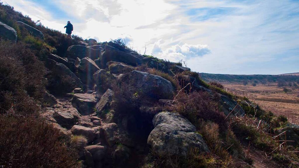
After the short ascent, the footpath continues beside a stone wall on your right hand side as you gently ascend to White Edge, reaching it at a path crossroads
Walk Along White Edge
At the path crossroads, turn right along the obvious path leading along the top of White Edge.
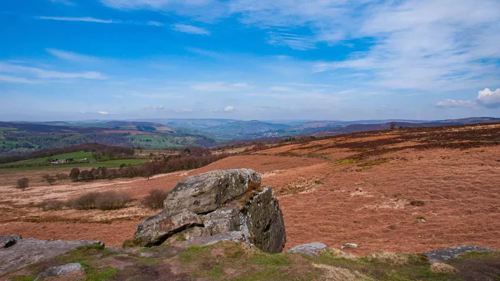
Along the White Edge footpath you will see to your right many of the iconic hills and edges. Sir William Hill lies to your right with the radio transmitter at the top. The “Witches Nose” of Win Hill Pike is clearly visible & farther to the right you can make out Bamford Edge. Almost behind you in the distance, you can see the climbing mecca of Stanage Edge.
After following White Edge for approximately 1.4 miles you will see the trig point ahead and to your left. As you’ve made the effort, you may as well “bag” the trig point by taking the path which leads up to it. Pass the trig pillar and continue along to rejoin the main path.
Continue for just over half a mile to reach another path junction. At this crossroads of paths, turn right on the path that heads downhill. With a stone wall to your right, descend and cross a stream, before climbing again. This path leads eventually to the road and car park at Curbar Gap.
Curbar Gap and Curbar Edge
On reaching the road beside Curbar Gap car park, turn right and head along the road, passing the car park on your right. Past the car park, as the road begins to descend, take the path through a gate on your right; then follow the path that heads to the left along the top of Curbar Edge.

The Curbar Edge path is very easy to follow and is a popular route, with stunning views to your left over Calver, the River Derwent and over to Eyam Moor. From this point no further directions are needed to continue along Curbar and then Froggatt Edge

Froggatt Edge to Hay Wood
Froggatt Edge leads on from Curbar Edge. Continue along this main path; after passing Froggatt Edge the path becomes more tree-lined. Continue along the wooded path which, as for the rest of this route, is clear and easy to follow.

At a fork where the path bears around to the right, keep straight on to descend to the main A625 road, which is reached through a gate.
Turn right then cross the road with care, as the path crosses the main road in the middle of an S-bend. After crossing the road, pass through a gate and drop to a stream which is crossed by stepping stones.
On the opposite side of the stream, the footpath climbs up through a gate and heads up to Hay Wood car park. Take the path fork that leads just behind the car park. If you began your walk here, this marks the end of the route. If you parked at The Grouse Inn, continue on.
Hay Wood to The Grouse Inn
At the north corner of the Hay Wood car park (just opposite the vehicle entrance) take the footpath leading north, slightly uphill, then fork half-right. A clear path heads up towards the A625 and the public house, emerging onto the road just before the pub. The roadside parking is just to your right.
